Two storey, double-fronted, semi-detached house with two storey extension to rear and single storey extension to west gable. Originally constructed before 1868 (present on Ordnance Survey 1:2500 1st edition map of that date).
The house was originally a single-storey structure with a thatched roof, until an additional, slate-roofed storey was added in the 1930s. Early photographs show that the gable extension was earlier roofed with corrugated iron, before both it and the main house were raised and re-roofed in slate just prior to WW2.
Old photographs suggest that Creg y Shee was built on to the existing west gable of Cummal Beg, making it the younger of the two properties, and that originally only the westerly or left-hand room had a hearth.
The site of a possible round house or hut circle associated with the rectilinear structure PRN 0720.00. It has an external diameter of 7.0 metres and the maximum height of its wall bases is 0.4 metres. Two smaller circular structures here have external diameters of 5.0 metres and wall bases up to 0.2 metres high. No entrances are traceable.
The site has been proposed as a possible keeill but are in a highly inaccessible and unlikely spot for a keeill. The hut circles do not resemble the built-up mounds of medieval shielings and are thus more probably Iron Age or perhaps Bronze Age in date.
The site of a very ruined building, reduced to wall bases, which is thought to be a possible early medieval keeill, but may represent a settlement site. It is situated on the east side of a hill on a platform approximately 20.0 metres wide running northeast to southwest between two areas of rock outcrops. It consists of five features, including a rectangular building orientated east-west, which measures 13.4 metres by 4.9 metres internally to the west end, narrowing to 2.4 metres to the east end. The south wall consists of a single line of boulders, average 0.4 metres high, which may by the remains of part of the inside and part of the outside of the wall thus giving the effect of it not being parallel with the north wall. The north wall consists of smallish stones, many of which are dislodged, and averages 2.0 metres wide. The east wall is similarly formed but 1.0 metre wide. A sheer rock face 3.5 metres high forms the west wall. the east wall has rounded corners. It is possibly the remains of a Viking long house, but the use of the rock face and irrregular plan may indicate that it is a sheep fold.
Modern watermill and associated water management.
Historical rentbooks show that a mill has existed on this site since at least 1631.
The Ordnance Survey 1:2500 First Edition mapping of 1868 shows a corn mill at this location.
The mill is immediately adjacent to the Silver Burn, and the wheel was located on the north gable. The millpond is located immediately to the northwest, and is fed by a leat which is taken off the river 250m upstream. The leat was protected by a sluice at its upper end, and an overflow sluice prevented the millpond from overtopping.
The complex is now used as a retail and visitor facility.
Modern watermill.
Historical rentbooks show that a mill has existed on this site since at least 1631.
The Ordnance Survey 1:2500 First Edition mapping of 1868 shows a corn mill at this location.
The mill is immediately adjacent to the Silver Burn, and the wheel was located on the north gable.
The complex is now used as a retail and visitor facility.
Modern watermill and associated water management.
Historical rentbooks show that a mill has existed on this site since at least 1631.
The Ordnance Survey 1:2500 First Edition mapping of 1868 shows a corn mill at this location.
The millpond is located immediately to the northwest of the mill, and is retained by a substantial dam embankment on its east and south sides.
It is fed by a leat which is taken off the river 250m upstream. The leat was protected by a sluice at its upper end, and an overflow sluice prevented the millpond from overtopping.
The complex is now used as a retail and visitor facility.
A site where lintel graves have been reportedly found, perhaps indicating the presence of a burial ground. The record is based on an annotation on a map of antiquarian observations kept in the MNH library: there is no other tradition associated with the area to confirm this.
The grid reference relates to the centre of the field in which the annotation is recorded.
Cregneash is a small crofting village in the southwest of the Isle of Man, about a mile from Port Erin, most of which now forms a living folk museum run by Manx National Heritage, officially opened in 1938. Restored thatched cottages preserve the look and material culture of 19th-century Manx village life, including Victorian-era farming and fishing equipment. Harry Kelly's Cottage demonstrates traditional weaving and blacksmithing, while Edward Faragher's Cottage focuses on Manx-language heritage. External controls on private homes in the village help maintain its historic appearance, and it keeps a flock of the rare, primitive four-horned Loaghtan sheep breed native to the island. St Peter's Church, built in 1878, still holds regular Sunday services for the community.
The findspot of a small flint flake of Mesolithic date.
The find was made within OS Plot 2031, which is centred at the grid reference provided. Cregneash Hill is not a recognised historical placename, and the plot number clarifies that the find was made on the north side of Cronk ny Arrey.
The Cregneash Shipping Direction Finding Station was a mid-20th century installation located on Cronk-ny-Array hill to the east of Cregneash.
Two masts are shown on historical OS 1:10560 scale mapping published in 1958 to the south and east of the technical buildings, together with the annotation, 'Automatic Wireless Transmitting Direction-finding Station (Shipping)'.
The masts have now been removed and the buildings converted for residential use.
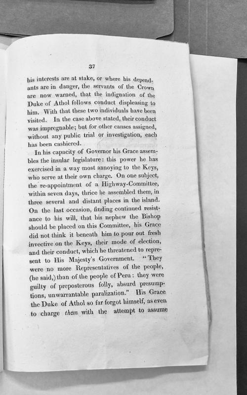
This excerpt from a printed pamphlet critiques the Duke of Athol's exercise of gubernatorial power over the Manx legislature, particularly his treatment of Crown servants and repeated assemblies of the House of Keys over a Highway Committee appointment dispute. It documents his attempts to force his nephew the Bishop onto the committee and his inflammatory rhetoric against the Keys' independence.