Natural harbour on the southeast coast of the Isle of Man, immediately east of Ronaldsway and Castletown.
Derbyhaven was known in earlier forms as Rainsway or Ronaldsway and served as the principal roadstead for Castletown. Sacheverell described it as "a reasonable good harbour", secured by a fort on a small island dedicated to St Michael.
St Michael's Isle lies at the eastern side of the bay and carried both a chapel and fortification. The harbour and island formed part of the defensive approaches to Castletown, while the broader bay gave vessels more room than the small inner harbour beside Castle Rushen.
The shore around Ronaldsway and Derbyhaven was also the scene of medieval fighting. In 1270 a Scottish force landed there and defeated the Manx. Later accounts give the Manx loss as Ivar and 686 of the chief men of the Island.
Richard de Mandeville and his Irish followers landed at Ronaldsway in 1316 before advancing inland and defeating the Manx near South Barrule.
In 1650 James Stanley, seventh Earl of Derby, narrowly escaped an attack in the bay. As he returned by boat from visiting a Parliamentary vessel, a gun was fired at him. Colonel Snaid, Colonel Richard Weston and Philip Lucas, the master of the boat, were killed.
Robertson's list of appointed ports in 1776 names Derbyhaven as a port with Castletown harbour, Poolvash, Port le Marie, Port Erin, Fleshwick and Niarbyl as its creeks.
Lintel-graves within a possible burial ground have been recorded here. 'A number of years ago, stone cists containing human remains were turned up on improving circular eminence situated in the field west of Ronaldsway farmhouse. The mound is apparently artificial, higher on the east and west sides, being hollow in the centre, it is about 4 foot in height, and about 100 foot in diameter. Supposed by the authority quoted to have been a place of burial. Many cartloads of stones were also removed possibly.
Although this information does not appear to have warranted Ordnance Survey publication, given that the site 'in the fields west of Ronaldsway farmhouse', is correct, the report of a lintel-grave found at the medieval smelting-site in 1935, and the reference to 'Reports had reached Mr W.C. Cubbon of Rushen Abbey, Ballasalla, that a series of graves had been uncovered some 20 yards from this spot', it would seem likely that a burial ground existed in this area; possibly an extension of the Early Christian burial ground (at SC 29026858) and/or possibly later (see Stennings' Lintel-grave, which may be post-15th century).
Derbyhaven (Manx: Camys y Ree, 'King's Harbour') was historically regarded as the Isle of Man's most important harbour due to its proximity to Castletown. Derby Fort, on the tidal St Michael's Isle guarding the harbour entrance, was built in 1645 by James Stanley, 7th Earl of Derby, replacing an earlier fort raised around 1540 under Henry VIII. Herring houses built in 1771 on the shore were used for salting and smoking the catch, reflecting the port's fishing heritage.
Modern herring houses.
The Ordnance Survey 1:2500 First Edition mapping of 1868 shows two long buildings and several smaller associated structures forming a complex at this location, arranged around an enclosed yard, and including what may be a walled garden.
The original herring houses were built, together with a large house, by John Joseph Bacon in 1771, at a cost of £1,200.
One large building (shown undivided on the original OS) occupies a substantial part of the easterly frontage onto the road leading to St Michael's Isle. This structure formed the herring houses. It is currently subdivided into two, and the more southerly half occupied as a dwelling. The northerly portion is used for storage, although it would seem to have been altered for domestic use at first floor level in the past.
Archive photographs taken before conversion to domestic use would suggest that the building may have been divided into three, and later four, areas at ground level, each served by a wide vehicular doorway opening onto the road; the two more northerly examples retain and are characterised by their arched doorheads. Doorways at first floor level appear to have served for loading vehicles standing in the roadway below. An extension to the north gable present by the 1868 survey is of similar character and would seem on photographic evidence to have been used for similar purposes; this is now demolished and replaced by a dwelling. The combined length of the roadside frontage was 55m, now reduced to 47m.
A large building on the same axis to the rear (west) shown on the original OS was 37m long and 8m deep. This was a very tall structure when originally constructed, substantially overtopping the herring houses to the east, and dominating all other buildings in Derbyhaven until the construction of the ornate late Victorian Marine Hotel in the centre of the village. It appears from old photographs to have had few original openings save for seven small, regularly spaced, windows under the eaves on each elevation; these were characterised by arched windowheads. Its design and lack of groundlevel windows suggest that it is likely to have been a storehouse.
The building was still roofed in the 1920s, but the entire roof structure and gable peaks above eaves height had gone by the 1970s. Photographs from the early 1980s show that the southern part was protected by a modern flat roof, but this part of the building has since been reduced to a single storey. The northern end of the building has been substantially redeveloped for domestic use and is now joined to the nearby eastern building by a modern link.
The walled yard associated with the herring house complex has now been largely redeveloped, particularly at its northern end, but the rear (west) boundary wall still survives, despite several breaches. At least two wells, capped by pumps at the time of the original OS, have been covered in.
Modern herring houses.
The Ordnance Survey 1:2500 First Edition mapping of 1868 shows two long buildings and several smaller associated structures forming a complex at this location, arranged around an enclosed yard, and including what may be a walled garden.
The original herring houses were built, together with a large house, by John Joseph Bacon in 1771, at a cost of £1,200.
A large building (shown undivided on the original OS) occupies a substantial part of the easterly frontage onto the road leading to St Michael's Isle. This structure formed the herring houses. It is currently subdivided into two, and the more southerly half occupied as a dwelling. The northerly portion is used for storage, although it would seem to have been altered for domestic use at first floor level in the past.
Archive photographs taken before conversion to domestic use would suggest that the building may have been divided into three, and later four, areas at ground level, each served by a wide vehicular doorway opening onto the road; the two more northerly examples retain and are characterised by their arched doorheads. Doorways at first floor level appear to have served for loading vehicles standing in the roadway below. An extension to the north gable present by the 1868 survey is of similar character and would seem on photographic evidence to have been used for similar purposes; this is now demolished and replaced by a dwelling. The combined length of the roadside frontage was 55m, now reduced to 47m.
Modern herring houses.
The Ordnance Survey 1:2500 First Edition mapping of 1868 shows two long buildings and several smaller associated structures forming a complex at this location, arranged around an enclosed yard, and including what may be a walled garden.
The original herring houses were built, together with a large house, by John Joseph Bacon in 1771, at a cost of £1,200.
A large building parallel to, but set back from, the road to St Michael's Isle, was shown on the original OS to the rear (west) of the roadside herring houses (PRN 2157.10). It measured 37m long and 8m deep. This was a very tall structure when originally constructed, substantially overtopping the herring houses to the east, and dominating all other buildings in Derbyhaven until the construction of the ornate late Victorian Marine Hotel in the centre of the village. It appears from old photographs to have had few original openings save for seven small, regularly spaced, windows under the eaves on each elevation; these were characterised by arched windowheads. Its design and lack of groundlevel windows suggest that it is likely to have been a storehouse.
The building was still roofed in the 1920s, but the entire roof structure and gable peaks above eaves height had gone by the 1970s. Photographs from the early 1980s show that the southern part was protected by a modern flat roof, but this part of the building has since been reduced to a single storey. The northern end of the building has been substantially redeveloped for domestic use and is now joined to the nearby eastern building by a modern link.
Modern well.
The Ordnance Survey 1:2500 First Edition mapping of 1868 shows two long buildings and several smaller associated structures forming a complex at this location, arranged around an enclosed yard, and including what may be a walled garden.
The original herring houses were built, together with a large house, by John Joseph Bacon in 1771, at a cost of £1,200.
The walled yard associated with the herring house complex has now been largely redeveloped, particularly at its northern end, but the rear (west) boundary wall still survives, despite several breaches. A well, capped by a pump at the time of the original OS, has been covered in.
Modern well.
The Ordnance Survey 1:2500 First Edition mapping of 1868 shows two long buildings and several smaller associated structures forming a complex at this location, arranged around an enclosed yard, and including what may be a walled garden.
The original herring houses were built, together with a large house, by John Joseph Bacon in 1771, at a cost of £1,200.
The walled yard associated with the herring house complex has now been largely redeveloped, particularly at its northern end, but the rear (west) boundary wall still survives, despite several breaches. A well, capped by a pump at the time of the original OS, has been covered in.
Modern lime kiln.
The Ordnance Survey 1:2500 First Edition mapping of 1868 shows a pair of kilns at this location. The annotation marks them as 'Limekilns', implying that they are active at this date.
The kilns were built consecutively, with the example to the south being the older.
Modern lime kiln.
The Ordnance Survey 1:2500 First Edition mapping of 1868 shows a pair of kilns at this location.
The older of the two kilns lies to the south.
Modern lime kiln.
The Ordnance Survey 1:2500 First Edition mapping of 1868 shows a pair of kilns at this location.
The more recent of the two kilns has been built against the north side of its neighbour.
The Ordnance Survey 1:2500 large scale mapping of 1867 records a small field at this location used as a stackyard (Manx, 'haggard'). It would seem likely that the stackyard was used to accommodate straw arising from thrashing undertaken in the building to the south, which was latterly used as a barn and contained a horse-driven mill (see 0139.30).
The enclosure no longer exists.
The grid reference provided indicates the centre of the stackyard as originally recorded by the OS.
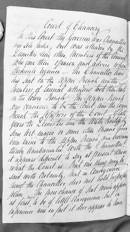
A legal or administrative document describing the structure and composition of the Court of Chancery on the Isle of Man, including the role of the Governor as Chancellor and sole judge, the advisory role of Deemsters and Council members, and recent changes whereby Deemsters and the Water Bailiff have been elevated to the Upper Bench alongside the Chancellor. The author expresses concern about the consequences of these structural changes.
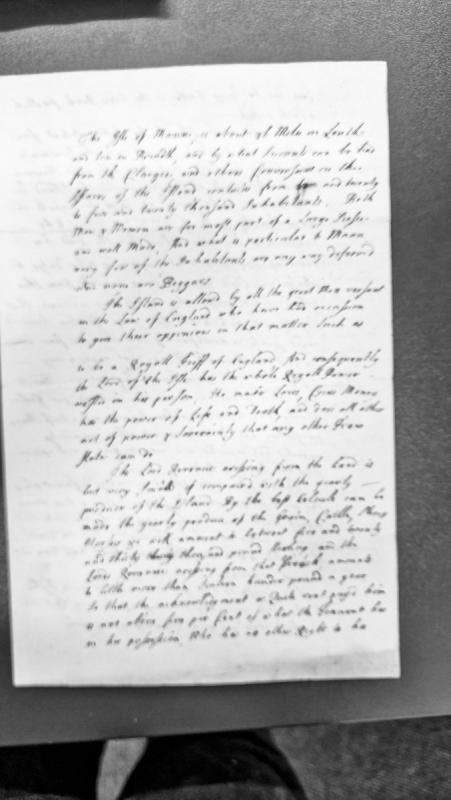
A descriptive account of the Isle of Man covering its dimensions (31 miles long, 10 miles broad), population estimates (24,000 inhabitants), physical characteristics of inhabitants, and its legal status as a Royal Feoff of England. The document discusses the Lord's regalia power and analyzes the island's economic productivity and revenue structure.
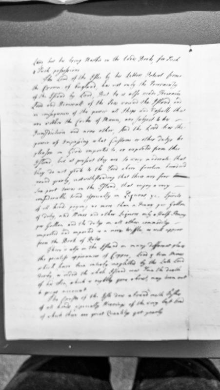
A document describing the Lord of the Isle's authority over Mann granted by Letters Patent from the Crown of England, including his sovereignty over land and sea, powers to impose customs duties, and the island's natural resources including mineral deposits and fishing grounds. The text notes the moderate customs revenues and the neglect of mining development under the late Lord Derby.
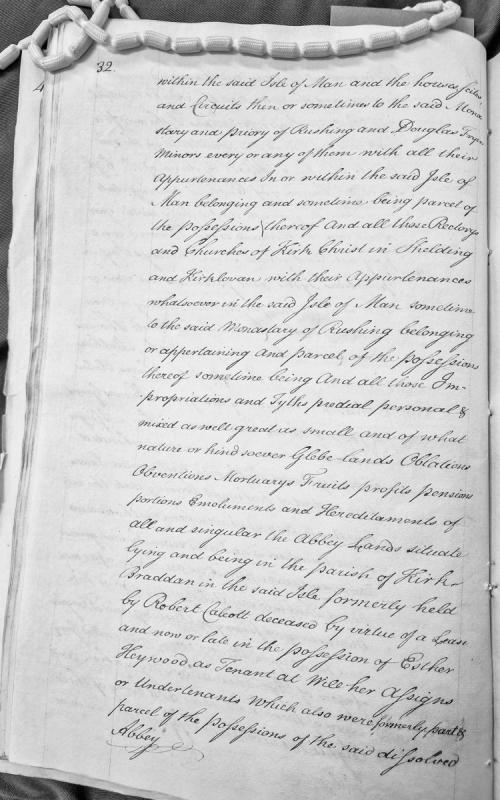
A legal document excerpt describing the extent and nature of lands, houses, churches, and ecclesiastical revenues belonging to dissolved monasteries in the Isle of Man. The text details properties formerly held by the Monastery of Rushen and others, including churches at Kirk Christ in Shelding and Kirklovan, along with various tithes, glebe lands, and other church revenues.
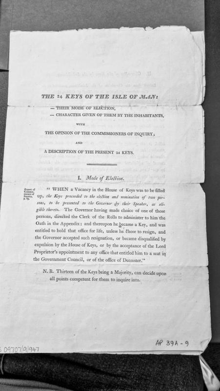
A printed pamphlet describing the structure and function of the House of Keys in the Isle of Man, including their mode of election as reported by the Commissioners of Inquiry. The document outlines the procedure for filling vacancies, the role of the Governor, and the requirements for holding office.
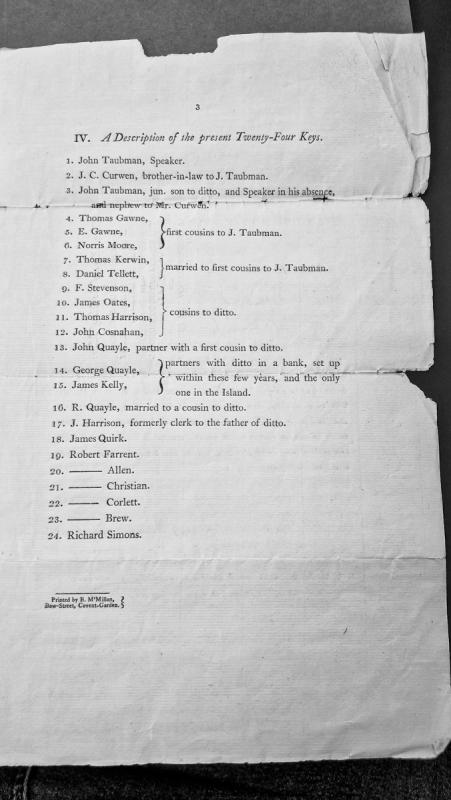
A printed list describing the composition of the House of Keys (the Manx legislature) at a particular point in time, identifying all 24 members by name and noting their family relationships, professional connections, and business interests. The document emphasizes the interconnected nature of the governing body through kinship and partnership ties.
The Isle of Man is full of carved stone crosses — really old ones, over a thousand years old. You can see them in churchyards and in the Manx Museum.
What makes them special is that they mix things up. Some have Celtic patterns — beautiful knots and spirals that go round and round and never end. Some have Norse pictures — Vikings, gods, dragons, and writing in runes. And some have both on the same stone. The people who carved them didn’t think they had to choose.
The most famous one is Thorwald’s Cross at Kirk Andreas. One side shows Odin being eaten by a giant wolf. The other side shows Christ standing on a serpent. Two completely different stories. Same piece of rock.
Your job: design your own cross that mixes things together. Use at least two different styles. Draw it, paint it, press it into clay, or build it from card.
Download colouring sheets and a pattern guide at revestment1765.com/downloads/
The conjectured site of a fort which has been dismissed as an unlikely site in recent times as there is no field or map evidence of its existence. It was described as being 'in the plantation near the Dhoon Bridge.'