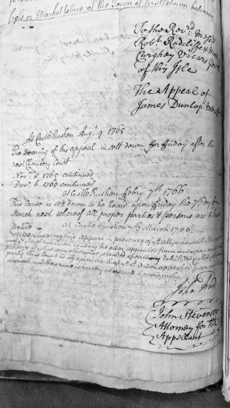
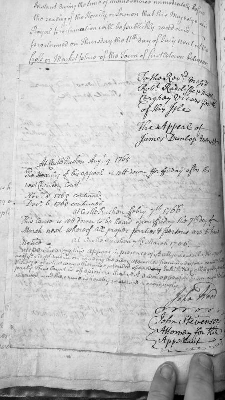
A court judgment reversing an order in an appeal case heard before the Ecclesiastical Court at Castle Rushen. The appeal of James Dunlop was initially scheduled for hearing in August 1765 and was continued several times before being finally heard on March 7th, 1766, resulting in the reversal of the original order.
A judgment document recording the hearing and reversal of an appeal by James Dunlop, a merchant, before the Castle Rushen court. The document traces the appeal's procedural history from August 1765 through March 1766, with multiple continuances, culminating in the court's decision to reverse the original order appealed from.
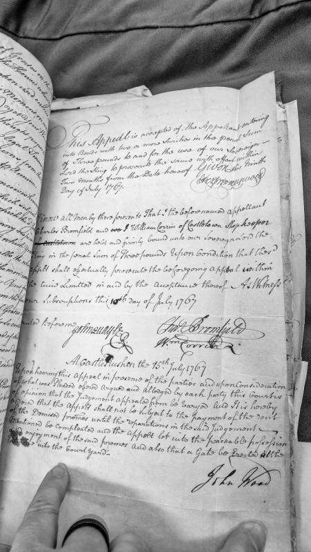
A House of Keys judgment dated 15 July 1767 reversing a previous judgment in an appeal concerning a rental property dispute. The appellant Charles Bromfield is relieved from paying rent until repairs are completed and he gains possession of the premises, with provisions for erecting a gate at the courtyard entrance.
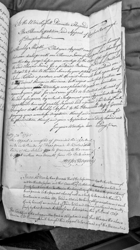
A petition and appeal by Charles Kavanagh of Douglas against an execution for £5.10.1 sterling granted by Demster Haywood at the suit of assignees of Thomas Lewis of Liverpool (bankrupt). The petition challenges the evidence presented by James Rostan as unjust and unlawful. The appeal was accepted on condition of a three-pound bond, which is detailed in the accompanying bond document dated March 9th 1765.
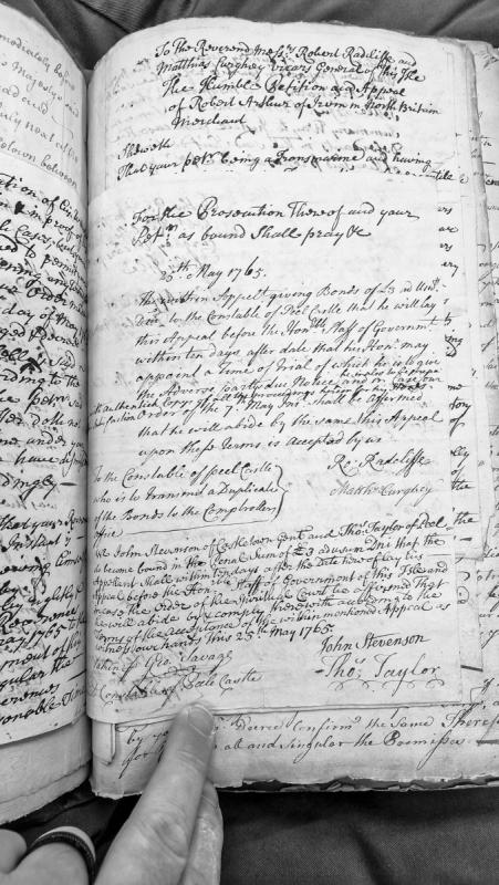
A humble petition and appeal submitted by Robert Arthur, a merchant from Irom in North Britain, to the Vicars General of the Isle of Man. The document records the acceptance of the appeal by Robert Radcliffe and Matthias Curghey, with bonds of £3 posted by John Stevenson and Thomas Taylor to ensure the appellant will present the case before the Government within ten days and comply with the court's decision.
A collection of four historical appendices to a scholarly work on Manx social and economic history. Appendix A presents an eyewitness account (mid-17th century) of formal reception procedures for arriving strangers in Man, describing the bureaucratic surveillance and interrogation apparatus. Appendices B-D document historical records on benevolences (1682), emergency defence procedures (1600), and debt imprisonment law (1418-1846), illustrating administrative structures and legal frameworks under the Lords of Man.
Editorial appendix from Monumenta de Insula Manniae clarifying the identity of an early Manx bishop named Hamond (son of Jole), and explaining how he was historically confused with Wimund, a 12th-century militant Norman monk. This source addresses medieval Manx ecclesiastical history and the reliability of chronicle sources.
A scholarly appendix from the Manx Society publications clarifying historical confusion between two medieval bishops: Hamond (a Manx bishop, son of Jole) and Wimund (a Norman monk and warrior-bishop). The text discusses how later historians erroneously conflated these figures and provides primary source citations from Matthew Paris and other chroniclers. Relevant to understanding medieval Manx ecclesiastical history and the reliability of historical sources used in Revestment-era scholarship.
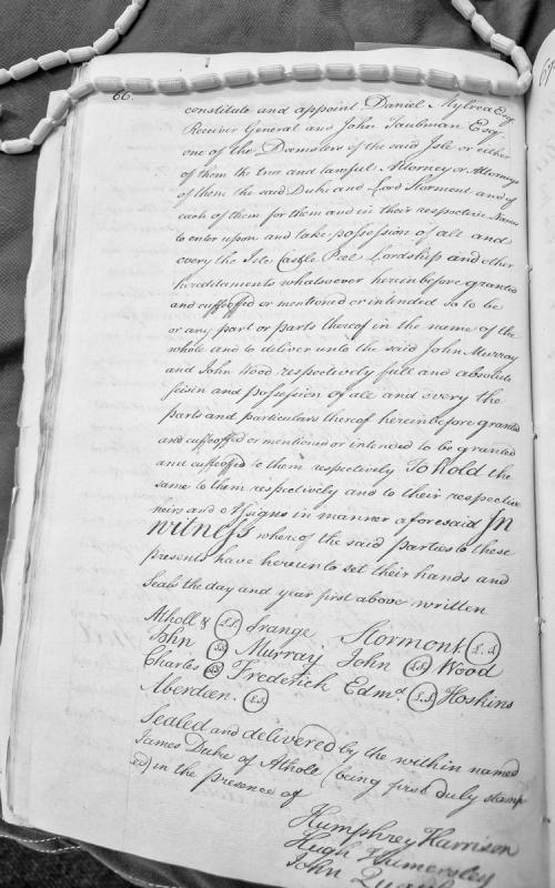
A legal instrument appointing Daniel Mylrea (Receiver General) and John Taubman (Deemster) as attorneys for the Duke of Atholl and Lord Stormont to take possession of Isle Castle, Peel, and other hereditaments, and to deliver seisin to John Murray and John Wood. The document is sealed and witnessed.
A royal patent from King Edward III appointing Edmund Mortayn, escheator of Ireland, and Brother John Tyrel to lead forces to recover the Isle of Man from Scottish invaders under Richard de Maundevill. The document is a Latin record from the Irish Patent and Close Rolls, published in the Manx Society's Monumenta de Insula Manniae series, and provides evidence of medieval Manx sovereignty disputes and military interventions.
Royal patent from Edward III appointing Edmund Mortayn, escheator of Ireland, and Brother John Tyrel to lead forces to recover the Isle of Man from Scottish occupation under Richard de Maundevill. The document reflects medieval military and administrative responses to threats to English sovereignty over the island, providing context for pre-Revestment Manx governance and English Crown interests.
Parliamentary Act of 1784 appropriating monies for naval, military, and civil services, including detailed expenditures for land forces, pensions, American loyalists, and colonial administration. Cap. XLV extends powers for trade with American colonies and British plantations. Relevant to understanding post-Revestment fiscal arrangements and imperial trade regulation affecting Isle of Man.
Parliamentary Act (24 Geo. III) appropriating funds for 1784 naval, military, and civil services, and extending powers for trade with American colonies and British plantations. Contains detailed financial schedules for army, ordnance, pensions, and civil establishments. CAP. XLV extends trade powers with United States and British American colonies. Provides context on post-American Revolution financial priorities and constitutional trade arrangements.
Letter from the Duke of Grafton (Secretary of State) to the Lords Commissioners of the Treasury enclosing approval from the King for barracks construction at Castle Rushen and Castletown, Isle of Man. The letter notes the removal of horse stables from the original plan following the withdrawal of cavalry from the island. This document records post-Revestment military infrastructure decisions and reflects the strategic assessment of Isle of Man's defence needs after 1765.
The monument is made of marble and engraved with a Celtic Cross. It was designed by Tom Sinden (Arbory Parish Commissioners). The monument was dedicated on 20th April 2016 by Reverend Colin Barry. It was presented by the Chairman of Manx National Heritage and a Representative of the Trustees of the Clague Cooil Briscoe Trust. The monument was received by Arbory Parish Commissioners.
Post medieval church, medieval church and burial ground.
The parish of Arbory appears to have borne a dual dedication to St Cairbre of Coleraine and St Columbcille: medieval documents refer to 'terram Sancti Carebrie' (1153) and 'ad ecclesiam Sancti Carber' (1291), but also to 'terram Sti. Columbae, herbery vocatam' (1231) and 'Parochia Sti. Columbae' (1511).
The reference to a church in 1291 would appear to confirm the presence of a medieval church on the site, and this may have been in whole or part the structure replaced in 1759 by the present church. The medieval church is itself likely to have replaced an older keeill structure.
The present church was dedicated on 1st November 1759 by Bishop Hildesley. Just four years later, the church was extended eastwards by the construction of a new chancel. The church bells were originally housed in a simple belfry above the west door which survived until 1915 when a new, and rather incongruous, tower was added.
Other than it being known that the previous church stood to the south of the present one, nothing is known of the latter's size or character; the same can be said of any earlier keeill which prompted the adoption of the site as the centre of the parish some time in the 12th century. It has been suggested that such a keeill may have been sited to the north of the current church, at the highest point in the old cemetery enclosure.
Lintel graves have been found on several occasions when digging modern graves, in 1893, 1902 and 1951. Graves were also found during building works outside the cemetery on the south side.
A sumner's pulpit stands outside the gate on the east side of the graveyard; its antiquity is unknown.
The manner in which the cemetery is confined by straight walls and roads on the east and south sides suggests the potential for the medieval graveyard to extend beyond the modern boundary, and this would appear to be confirmed by the previous discovery of graves already mentioned.
The grid reference is centred on the church.
Post medieval church.
The parish of Arbory appears to have borne a dual dedication to St Cairbre of Coleraine and St Columbcille: medieval documents refer to 'terram Sancti Carebrie' (1153) and 'ad ecclesiam Sancti Carber' (1291), but also to 'terram Sti. Columbae, herbery vocatam' (1231) and 'Parochia Sti. Columbae' (1511).
The present church was dedicated on 1st November 1759 by Bishop Hildesley. Just four years later, it was extended eastwards by the construction of a new chancel. The church bells were originally housed in a simple belfry above the west door which survived until 1915 when a new, and rather incongruous, tower was added.
Medieval church.
The parish of Arbory appears to have borne a dual dedication to St Cairbre of Coleraine and St Columbcille: medieval documents refer to 'terram Sancti Carebrie' (1153) and 'ad ecclesiam Sancti Carber' (1291), but also to 'terram Sti. Columbae, herbery vocatam' (1231) and 'Parochia Sti. Columbae' (1511).
The reference to a church in 1291 would appear to confirm the presence of a medieval church on the site, and this may have been in whole or part the structure replaced in 1759 by the present church. The medieval church is itself likely to have replaced an older keeill structure.
Other than it being known that the medieval church stood to the south of the present one, nothing is known of its size or character.
The grid reference is for indicative purposes only.
Medieval chapel.
The parish of Arbory appears to have borne a dual dedication to St Cairbre of Coleraine and St Columbcille: medieval documents refer to 'terram Sancti Carebrie' (1153) and 'ad ecclesiam Sancti Carber' (1291), but also to 'terram Sti. Columbae, herbery vocatam' (1231) and 'Parochia Sti. Columbae' (1511).
The reference to a church in 1291 would appear to confirm the presence of a medieval church on the site, which itself is likely to have replaced an older keeill structure.
The location of any early keeill which could have prompted the adoption of the site as the centre of the parish some time in the 12th century is unknown. It has been suggested that such a building may have been sited to the north of the current church, at the highest point in the old cemetery enclosure.
The grid reference is for indicative purposes only.
Post medieval burial ground.
The parish of Arbory appears to have borne a dual dedication to St Cairbre of Coleraine and St Columbcille: medieval documents refer to 'terram Sancti Carebrie' (1153) and 'ad ecclesiam Sancti Carber' (1291), but also to 'terram Sti. Columbae, herbery vocatam' (1231) and 'Parochia Sti. Columbae' (1511).
The present late 18th century church stands towards the northerly edge of the burial ground as delineated on the Ordnance Survey 1:2500 First Edition mapping of 1868. The church which it replaced would have stood more centrally in the burial ground as shown, but it is difficult to be sure of the extent and limits of the cemetery in earlier times owing to the encroachments of more recent development to the east, west and south. Lintel graves have been found on several occasions when digging modern graves, in 1893 (to the south), 1902 (to the north) and 1951 (to the south-west). Graves were also found during building works outside the cemetery on the south side.
The grid reference is centred on the burial ground as defined in 1868.
Modern burial ground.
The parish of Arbory appears to have borne a dual dedication to St Cairbre of Coleraine and St Columbcille: medieval documents refer to 'terram Sancti Carebrie' (1153) and 'ad ecclesiam Sancti Carber' (1291), but also to 'terram Sti. Columbae, herbery vocatam' (1231) and 'Parochia Sti. Columbae' (1511).
The present late 18th century church stands towards the northerly edge of the burial ground as delineated on the Ordnance Survey 1:2500 First Edition mapping of 1868. The church which it replaced would have stood more centrally in the burial ground as shown, but it is difficult to be sure of the extent and limits of the cemetery in earlier times owing to the encroachments of more recent development to the east, west and south. Lintel graves have been found on several occasions when digging modern graves, in 1893 (to the south), 1902 (to the north) and 1951 (to the south-west). Graves were also found during building works outside the cemetery on the south side.
The grid reference is centred on the westerly extension of the burial ground, which constitutes the first of the extensions created after the Survey of 1868.
Modern burial ground.
The parish of Arbory appears to have borne a dual dedication to St Cairbre of Coleraine and St Columbcille: medieval documents refer to 'terram Sancti Carebrie' (1153) and 'ad ecclesiam Sancti Carber' (1291), but also to 'terram Sti. Columbae, herbery vocatam' (1231) and 'Parochia Sti. Columbae' (1511).
The present late 18th century church stands towards the northerly edge of the burial ground as delineated on the Ordnance Survey 1:2500 First Edition mapping of 1868. The church which it replaced would have stood more centrally in the burial ground as shown, but it is difficult to be sure of the extent and limits of the cemetery in earlier times owing to the encroachments of more recent development to the east, west and south. Lintel graves have been found on several occasions when digging modern graves, in 1893 (to the south), 1902 (to the north) and 1951 (to the south-west). Graves were also found during building works outside the cemetery on the south side.
The grid reference is centred on the northerly extensions of the burial ground, which constitute the more recent extensions created after the Survey of 1868.
Post medieval sumner's pulpit The parish of Arbory appears to have borne a dual dedication to St Cairbre of Coleraine and St Columbcille: medieval documents refer to 'terram Sancti Carebrie' (1153) and 'ad ecclesiam Sancti Carber' (1291), but also to 'terram Sti. Columbae, herbery vocatam' (1231) and 'Parochia Sti. Columbae' (1511).
A sumner's pulpit stands outside the gate on the east side of the graveyard; it takes the form of a substantial raised platform and is the finest example on the Island (the remains of another stand on the south side of St Patrick's Church on St Patrick's Isle).
Its antiquity is unknown.
16 names listed; First World War. 8 names listed; Second World War.
White marble plaque.
The memorial was unveiled on 20 October 1922 by the Lieutenant Governor. The memorial was dedicated by the Lord Bishop. The Second World War commemorative tablets on the memorial were unveiled on Sunday 16 November 1947. The tablet was the work of Mr Charles Cubbon of Hope Street, Castletown.
First World War. Plaque, copper on wood surround.
There is also a framed photograph which is engraved "Lt. Henry Stuart Cooil 1889 - 1918." Parish Hall donated and built by parents of Henry Stuart Cooil. Upon the death of his father, Robert Henry Cooil, his will revealed that "The testator left £3000, payable three years after his decease, upon trust for the erection of a suitable monument or monuments to his sons, Henry Stuart Cooil and Anthony Cooil, in the Isle of Man, and preferably in the village of Ballabeg." (Peel City Guardian, 12 June 1920, p.2).