Official parliamentary record of House of Commons proceedings from 1765–1766, documenting legislative business including road repair bills, naturalizations, ecclesiastical land exchanges, military pay resolutions, and various petitions. Contains procedural records, committee assignments, and financial data relevant to mid-18th-century governance and revenue matters.
Parliamentary Journal recording testimony before a House of Commons committee examining petitions regarding River Tyne navigation problems, ballast disposal, and sanding of Tynemouth Harbour. Witnesses include ship masters, pilots, water bailiffs, and attorneys. Also includes petitions for canal construction linking Manchester, Stockport, Macclesfield, and Knutsford.
Extract from the official Journal of the House of Commons covering parliamentary proceedings from 1765. Contains detailed resolutions of the Committee of the Whole House establishing stamp duties on various documents and instruments in British colonies and plantations in America, alongside numerous local road and enclosure bills. Includes the revenue scheme for the Stamp Act and its disposal 'towards further defraying the necessary Expences of defending, protecting, and securing the said Colonies and Plantations.'
Official parliamentary proceedings from the House of Commons covering January-February 1766, including petitions, orders, committee reports, and accounts presented to Parliament. Contains records of trade accounts (exports/imports from colonies and overseas territories), petitions for road repairs and enclosure bills, and parliamentary business during the Stamp Act crisis period.
Extract from the official Journal of the House of Commons recording proceedings on 14 February 1766 (6 George III). Contains orders for colonial trade data, committee proceedings on Isle of Man-related papers presented by Secretary Conway and the Chancellor of the Exchequer, and numerous petitions regarding enclosure, roads, and infrastructure projects. References examination of witnesses including Benjamin Franklin and testimony on smuggling, leather trade, and glove manufacturing.
Testimony before a House of Commons committee examining the condition of the River Tyne, harbour silting, ballast discharge practices, and their impact on coal trade navigation. Includes detailed witness statements from ship masters, pilots, quay operators, and river bailiffs on sand accumulation, Middle Ground formation, and proposals for canal construction in Lancashire/Cheshire. Relevant to understanding parliamentary procedure, commercial interests, and infrastructure debates contemporary with the 1765 Isle of Man Revestment.
Extract from the House of Commons Journal for 1765-1766 containing detailed parliamentary resolutions on stamp duties for the American colonies and plantations, along with various local road and enclosure petitions. The stamp duty resolutions specify rates for land grants, legal instruments, publications, and other documents, with proceeds to be paid to the Exchequer for colonial defence. This source is crucial for understanding Westminster's fiscal policy toward the colonies and the administrative framework that would affect colonial trade and governance.
A 2025 House of Commons Library research briefing providing comprehensive overview of the constitutional status, governance structures, and UK Government relations with the Crown Dependencies (Jersey, Guernsey, Isle of Man). Covers legislative processes, international relations, and the impact of Brexit. Includes substantial sections on Isle of Man history, the 1765 Revestment (when the lordship reverted to the Crown due to smuggling), and comparative constitutional frameworks.
A comprehensive 2025 research briefing by the UK House of Commons Library examining the constitutional status, governance structures, and UK relations of the three Crown Dependencies (Jersey, Guernsey, Isle of Man). Covers legislative processes, international treaties, and the impact of Brexit. Includes detailed sections on Isle of Man's Tynwald system, historical background from 1765 Revestment, and intergovernmental relations.
A comprehensive contemporary research briefing on the constitutional status, governance, and international relations of Jersey, Guernsey, and the Isle of Man. Covers the historical background of Crown Dependencies including the 1765 Revestment, constitutional arrangements, UK relations, international treaties, and Brexit implications. Provides contextual framework for understanding the Isle of Man's unique position and development since the Revestment.
A comprehensive research briefing on the constitutional status, governance structures, and UK relations of the Crown Dependencies (Jersey, Guernsey, Isle of Man). Covers historical background, legislative processes, international relations, Brexit implications, and financial arrangements. Provides contemporary parliamentary context for understanding the Crown Dependencies' constitutional position within the UK framework.
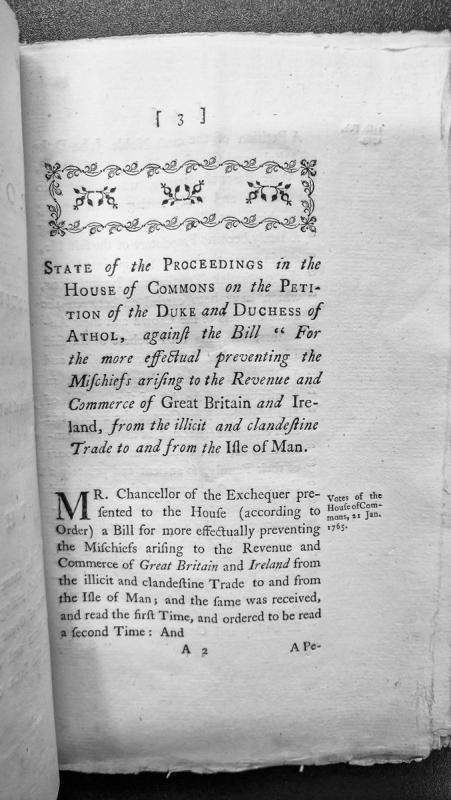
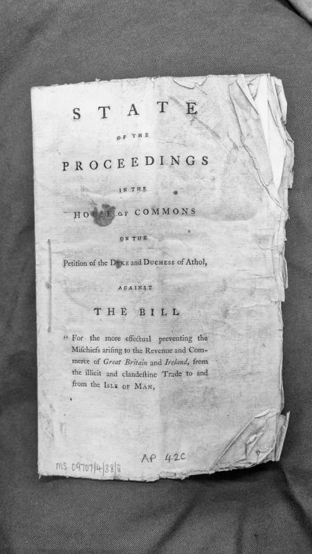
A printed record of proceedings in the House of Commons concerning a petition by the Duke and Duchess of Athol against a bill designed to prevent illicit trade to and from the Isle of Man. The Chancellor of the Exchequer presented the bill on 21 January 1765, which aimed to protect the revenue and commerce of Great Britain and Ireland.
A printed pamphlet documenting parliamentary proceedings in the House of Commons regarding a petition by the Duke and Duchess of Athol opposing legislation aimed at preventing illicit trade to and from the Isle of Man. The bill sought to protect the revenue and commerce of Great Britain and Ireland from clandestine trading activities.
The twenty-four-member lower branch of the Manx legislature.
The constitutional evidence printed by the Manx Society traced the Keys back into the medieval period. A declaration of Manx law made in 1422 stated that the body had once been known as the Taxiaxe and linked it with twenty-four freeholders, sixteen from Mann and eight from the Outer Isles. The same nineteenth-century editors treated the exact origin of the body and its earliest method of election as uncertain.
Twenty-four Keys are documented taking part in a public act in 1417. From at least that period until Revestment their number remained twenty-four.
For an indefinite period before 1765 the House filled its own vacancies through a system of nomination. The Keys selected two candidates and presented them to the Governor through their Speaker. The Governor chose one, after which the Clerk of the Rolls administered the oath and the successful candidate became a Key. Membership was for life unless the member resigned, was expelled or became disqualified by accepting an incompatible office.
A 1581 record shows that this system was already contested. Bishop Merick argued that where the Keys were participating in legislation binding the whole country, they ought to be chosen “by the whole consent of the country”, with representatives from each sheading. The record also states that the Twenty-four themselves maintained that the country should consent to their choice when establishing law.
The self-selecting system survived until the House of Keys Election Act 1866. Under that Act members were elected by voters in the six sheadings and the towns. Each sheading returned three members; Douglas returned three; Castletown, Peel and Ramsey one each.
By 1881 the franchise included certain property owners, tenants and lodgers. The Manx Society editor noted that unmarried women qualified to vote under the ownership franchise, though an attempt by the Keys to extend another qualification to women was restricted after disagreement with the Council.
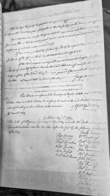
An administrative document containing directives regarding public debts, trade proposals, and import liberties, followed by a record of oaths taken by members of the House of Keys on 7 August 1765 in Castletown. The document includes orders from George Moore regarding proposals and applications for trade privileges.
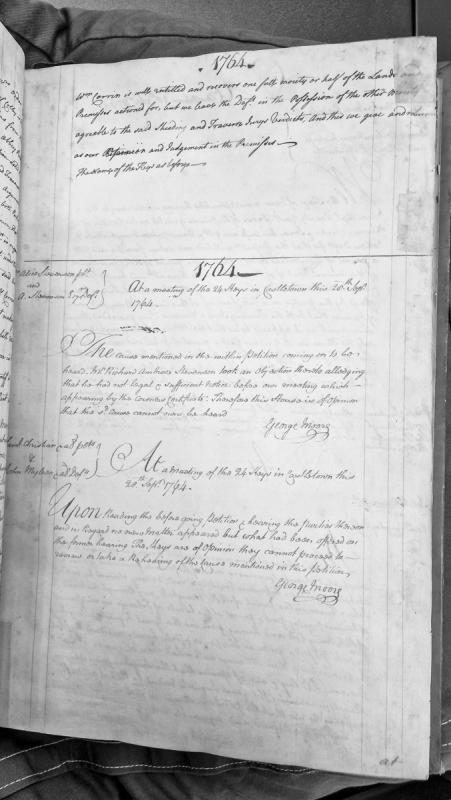
Two House of Keys rulings from a meeting in Castletown: the first dismissing a cause brought by Richard Ambrose Stevenson due to insufficient legal notice, and the second refusing to grant a rehearing in a cause between Daniel Christian (petitioner) and John Mylrea (defendant).
Collection of official correspondence and resolutions documenting the structural decay of the House of Keys in Castletown, Isle of Man. Includes architectural survey by Thomas Brine (October 1817), House resolutions authorizing removal to the George Inn, and subsequent correspondence between Lieutenant Governor Smelt and Home Secretary Lord Sidmouth regarding funding and reconstruction (1817–1819). Demonstrates governmental infrastructure challenges and Crown funding mechanisms for island institutions.
Official correspondence from Lieutenant Governor Charles Smelt to Home Secretary Lord Viscount Sidmouth reporting that the House of Keys (Manx legislature) was declared unsafe on 16 October 1817 by architect Thomas Brine's affidavit. Includes resolutions by House members to adjourn to the George Inn and requests for a government grant to rebuild. A follow-up letter from 7 October 1819 details the rebuilding contract with Brine and payment arrangements. Demonstrates post-Revestment governance infrastructure and the Crown's relationship with Manx institutions.
The House of Keys Election Act gave Manx people the right to elect their own representatives for the first time. Previously the Keys had been a self-electing body. The Act was the culmination of forty-five years of petitioning — the constitutional machinery that the Revestment had silenced, slowly restarting.
Act of Tynwald which replaced the self-selecting House of Keys with an elected chamber.
Before 1866 vacancies in the twenty-four-member House were filled through nomination by the remaining Keys and selection by the Governor. The 1866 Act changed that structure by making membership dependent on election by voters in the sheadings and towns.
The six sheadings each returned three members. Douglas returned three, while Castletown, Peel and Ramsey returned one member each, preserving the total of twenty-four. The House was elected for seven years unless dissolved sooner.
The Act’s own printed title described it as “An Act to render the House of Keys elective; and for other purposes”. An authorised edition was printed in Douglas in 1866 by H. Curphey of the Manx Sun Office in King Street.
The first dissolution under the new system followed the procedure laid down in section 138 of the Act. Later constitutional discussion repeatedly referred to the powers given to the Lieutenant-Governor to summon the Keys and to questions about the relationship between the elected House and the executive.
The franchise created in 1866 remained restricted and was altered by later legislation. The House of Keys Election Act 1881 expanded and reorganised voter qualifications, so the 1866 settlement should be understood as the beginning of an elected Keys rather than the creation of universal suffrage.
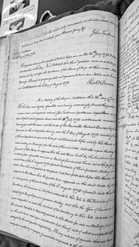
A House of Keys proceeding documenting a petition by John Taubman (Gentleman) against a defendant named Lace. The document includes the original petition dated 26 July 1775, an order by Governor Richard Dawson dated 3 August 1775 directing the matter to the House of Keys, and the Keys' assembled response indicating consideration of the case and jurisdictional questions.
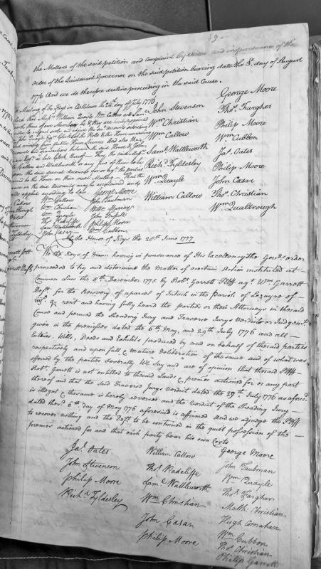
A House of Keys judgment dated 28 June 1777 determining a common law action instituted 8 December 1775 by Robert Garrett (plaintiff) against William Garrett (defendant) concerning an intack (enclosed land) in the Parish of Lezayre. The Keys reversed the traverse jury's verdict of 29 July 1776, affirmed the sheading jury's verdict of 6 May 1776, and ruled in favour of the defendant.
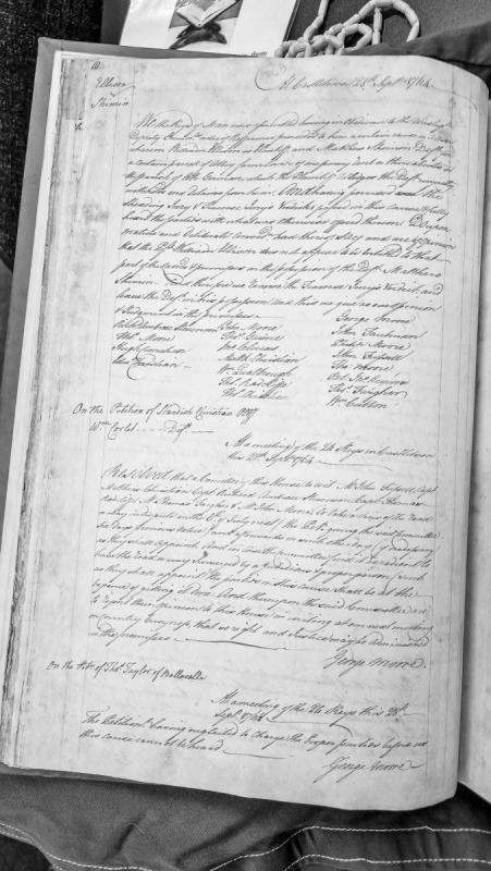
Record of House of Keys proceedings at Castletown on 28 September 1764, containing a judgment reversing a Traverse Jury's verdict in a land dispute over Abbey farm land in the parish of Kirk German between William Ellison (plaintiff) and Matthew Shimin (defendant). The document also records resolutions on petitions regarding a disputed road and a case by Thomas Taylor.
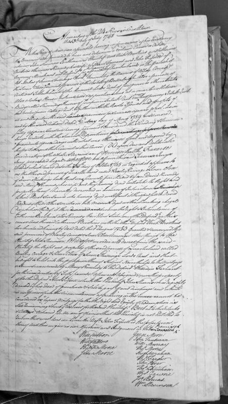
A judgment of the House of Keys assembled at Castletown determining a property dispute over quarterlands and cottage in the Parish of Malew. The Keys affirm a Traverse Jury verdict from 1765, awarding John Swanson possession of Bradly Corage and Simer Close but subject to a mortgage held by William Tarrant, and denying him the Intacks and Cottage.