Bronze Age burials.
The Ordnance Survey 1:2500 First Edition mapping of 1867 shows the site of a chapel and burial ground at this location, formerly named Killkellan, together with the annotation, 'Site of Chapel & Burial Ground'. The OS places a marker within a small enclosure to the east of the road, which is defined by a curvilinear field boundary.
Dr J Bradbury (1894), when describing the nearby archaeological discoveries at the time he was writing, recorded the previous discovery in the field to the west of the road, of 'many urns?unearthed at various times' which he considered to be a continuation of the prehistoric cemetery described under PRN 0657.60.
Bradbury must be referring to OS Field no. 2507, and notes that it traditionally bore the name Bwoailley Khallane (chapel field). It is clear from his description that, despite its name, the field had only yielded prehistoric burials to his knowledge.
No similar discoveries within the field have since been reported.
Charles III (b. 1948) is the current King of the United Kingdom and Lord of Mann, having acceded to the throne in 2022 upon the death of his mother, Elizabeth II. He has visited the Isle of Man on several occasions, including in his earlier role as Prince of Wales.
James I (1566-1625) was King of England and Scotland from 1603 to 1625. During his reign, the lordship of Mann continued under the Stanley family, Earls of Derby, and the Island was affected by the broader political and religious tensions of the early Stuart period.
John (1166-1216), King of England from 1199 to 1216, and the first English king to take the King of Mann under his protection.
The instrument survives among the Manx national documents. In 1205 the King declared to all that he had taken his beloved kinsman Reginald, King of Mann, under his keeping, protection and defence, together with all his lands and people, and forbade any person to trouble them.
There was a price on both sides. Reginald, the fifth of the Norse line and reckoned a usurper by the Manx chroniclers, agreed to do homage to John for the Isle of Man and the out Isles, and by John's charter he was to receive a knight's fee of two tuns of wine and a hundred and twenty quarters of corn yearly out of Ireland. The kings of that race had until then been held to take their sovereignty from the kings of Norway, to whom they owed homage, so the arrangement of 1205 marks the point at which an English claim was formally admitted.
Reginald went further in the same direction and took the Pope for his lord as well. In 1219, following the example of his protector King John, he became the vassal of the Roman Church, engaging to hold his kingdom of it for an annual payment of twelve marks sterling, and the kingdom of Man thereby became a dependency of the Papacy. Manx writers set the two acts side by side, and note that it was Edward I who broke John's papal yoke of tribute from England's neck, while the reversal of the same process in the Island was left to the greatest of the insular kings of the house of Stanley.
A charter issued by King John of England placing Reginald, King of Mann, under royal protection. The document guarantees Reginald's safety and that of his lands and people, forbidding any harm to them. Relevant to understanding early medieval Manx sovereignty and the island's relationship with the English Crown, providing constitutional and political context predating the 1765 Revestment.
A royal charter in which King John of England takes Reginald, King of Mann, under his protection, defence, and custody, extending protection to all his lands and people. This is a foundational document for understanding the feudal relationship between the English Crown and the Kings of Mann in the medieval period, establishing the protectorate model that would evolve through subsequent centuries leading to the 1765 Revestment.
A royal letter patent from King John of England protecting the King of Mann and his possessions from incursion by Irish mariners. This early 13th-century document demonstrates English Crown assertion of authority over Mann and establishes a precedent for protective sovereignty. It is relevant to understanding the constitutional relationship between England and Mann in the pre-Revestment period.
A royal writ from King John of England protecting the territory and possessions of the King of Mann from unauthorized entry by English mariners and Irish ships. The document establishes early English royal recognition and protective authority over Mann, predating the Revestment by over 550 years. It is transcribed from Rotuli Litterarum Patentium and appears in the Manx Society's Monumenta de Insula Manniae collection.
Magnus, the last Norse King of Mann, died in 1265 at Castle Rushen and was buried in the abbey church he had lately caused to be dedicated - understood to mean Rushen Abbey, Ballasalla, though the existing item does not name the abbey explicitly.
Olave, third son of Godred Crovan, King of Mann and the Isles, who reigned some forty years and died in 1153.
He came to the throne after his brothers. The Chronicle of Man records that Godred Crovan died in Islay leaving three sons, Lagman, Harald and Olave, and the succession lists of the Island give Olave as the third son of Godred, followed by Godred his own son, then Reginald the natural son of Godred, then Olave the lawful son, then Harald son of Olave, then Reginald II and Magnus II his brothers, and after them Alexander King of Scots.
The Chronicle credits him with keeping peace through his long reign, and his son Godred II succeeded him.
Bronze Age burial mound. The obvious feature is the large burial cist, the cap- and side stones of which are exposed in the roadside hedge. The burial chamber was originally covered by a large circular mound, half of which was cut away for road widening in 1848. The mound would appear to have been about 18m in diameter and 2m high before the roadway was widened and deepened.
The cist measures 1.3 by 0.8m and 0.9m deep, while the capstone has maximum dimensions of 2.1 by 1.3 by 0.3m.
Neolithic chambered tomb. Despite its name, which is an invention of local folklore, the tomb was begun as much as 6,000 years ago, and comprises two separate chambered monuments. It is a rare example of two such tombs built in such close proximity that they have become confused as one. The two tombs were probably constructed several hundred years apart.
The westerly tomb comprises two rectangular chambers built using massive slabs of local stone which may have been collected from several miles around. The original construction involved the chamber nearer the house, but a second, subdivided chamber was later built and a forecourt added at the end furthest to the south-west which took the form of a shallow horseshoe overlooking the nearby gully and the main Laxey valley. Only one tall stone and the stumps of several others survive to indicate how these standing stones held back a cairn of rubble which was built up over the burial chambers. The early part of the structure is comparable with Cotwold tombs, whilst the forecourt is reminiscent of tombs in south-west Scotland and Northern Ireland.
Neolithic chambered tomb. Despite its name, which is an invention of local folklore, the tomb was begun as much as 5,500 years ago, and comprises two separate chambered monuments. It is a rare example of two such tombs built in such close proximity that they have become confused as one. The two tombs were probably constructed several hundred years apart.
The easterly tomb, which faces north-east, consists of a segmented chamber of at least three compartments covered by a trapezoidal-shaped cairn with a deep U-shaped forecourt and a fa?ade of impressive slabs linked by dry-stone walling and two fine portal stones. It is possible that the chamber extended further, but has been cut away by the construction of a road and a house during the 19th century. The portal is now blocked by a stone which may have fallen or been deliberately placed in front. The entire forecourt is also closed off by a line of stones placed between the tips of the horns, but it is not entirely clear if this is a deliberate act of closure during prehistoric times or a more recent structure associated with agricultural activity in the area in modern times.
Neolithic chambered tomb. King Orry's Grave is one of perhaps ten Neolithic chambered tombs that are known on the Island. Despite its name, which is an invention of local folklore, the tomb was begun as much as 5,000 years ago, and comprises two separate chambered monuments. It is a rare example in the British Isles of two such tombs built in such close proximity that they have become confused as one. The two tombs were probably constructed several hundred years apart.
The westerly tomb comprises two rectangular chambers built using massive slabs of local stone which may have been collected from several miles around. The original construction involved the chamber nearer the house, but a second chamber was later built and a forecourt added at the end furthest to the south-west which took the form of a shallow horseshoe overlooking the nearby gully and the main Laxey valley. Only one tall stone and the stumps of several others survive to indicate how these standing stones held back a cairn of rubble which was built up over the burial chambers. The early part of the structure is comparable with Cotwold tombs, whilst the forecourt is reminiscent of tombs in south-west Scotland and Northern Ireland.
The easterly tomb, which faces north-east, consists of a segmented chamber of at least three compartments covered by a trapezoidal-shaped cairn with a deep U-shaped forecourt and a facade of impressive slabs linked by dry-stone walling and two fine portal stones. It is possible that the chamber extended further, but has been cut away by the construction of a road and a house during the 19th century. The portal is now blocked by a stone which may have fallen or been deliberately placed in front. The entire forecourt is also closed off by a line of stones placed between the tips of the horns, but it is not entirely clear if this is a deliberate act of closure during prehistoric times or a more recent structure associated with agricultural activity in the area in modern times.
King Orry's Grave is the largest megalithic tomb on the Isle of Man, a Neolithic chambered cairn dating to roughly 4,000-5,000 years ago, sited in the Minorca area on the northern edge of Laxey. Despite the name, it has no genuine connection to the Norse King Orry (Godred Crovan); the attribution is folklore layered onto a monument many centuries older than the Norse period. The site survives in two separate sections either side of a road, the result of nineteenth-century road and house building cutting through what was originally one monument: an eastern section with a semicircular, U-shaped forecourt and three burial chambers under a trapezoidal cairn, and a smaller western, cist-like section with a standing stone, excavated in 1930. It is managed by Manx National Heritage, with public access to both sections, one of which lies partly within a private garden.
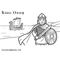
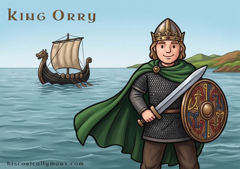
Godred Crovan sailed to the Isle of Man in 1079. He was Norse-Gaelic, a survivor of Stamford Bridge, and he came by sea.
The Manx people named the Milky Way after him — Raad Mooar Ree Gorree, the Great Road of King Orry, the path his ships followed across the night sky.
On a clear night, go outside and find the Milky Way. You’re looking at the same sky Godred’s sailors navigated by nearly a thousand years ago.
Bring a blanket. Bring a flask of something warm. Bring the story of how a man who lost at Stamford Bridge won a kingdom in the Irish Sea.
It is recorded that Mr Frank Matthews of Glen Moar opened a cist grave on the Peel side of the megalithic tomb known as King Orry's Grave (PRN 0934.00). This grave was said to be 'much smaller in size' than the megalithic tomb, but was found to contain a 'battle-axe, a stirrup and a handful of beads of various colours, shapes and sizes'. The beads and ornaments were preserved in the Jermyn Street Geological Museum, London for some time during the mid-19th century, but now appear to be lost. The 'battle-axe and stirrup' could not be traced even as early as 1868. The finds have been interpreted as representing a Viking burial, possibly of the 9th century.
A burial ground apparently stood 'on the Western edge of the natural plateau on which stands Tynwald Hill, about 193 yards West-South-West of the mound... Here, at a height above sea-level of about 145 foot, lintel graves have been found in ploughing, and from the description given of them by Mr Matthews, and the stones found in them, now lying in the hedge, they appear to have been Christian' but no keeill was found in association with them...'.
A sword fragment from the same vicinity was presented to the Manx Museum in 1937 by Mr T.C. Moore who stated that it was found some years previously by workmen employed in digging gravel.
King William's College at Castletown was almost totally destroyed by fire in the early hours of Sunday 14 January 1844; the blaze, whose origin was never discovered, broke out in the school-room and spread before engines summoned from Douglas could arrive. The college's valuable library was lost, including a rare collection of Bibles in more than fifty languages and unique manuscripts on Manx ecclesiastical history, along with military models and plans. The college was rebuilt to a somewhat different design that same year.