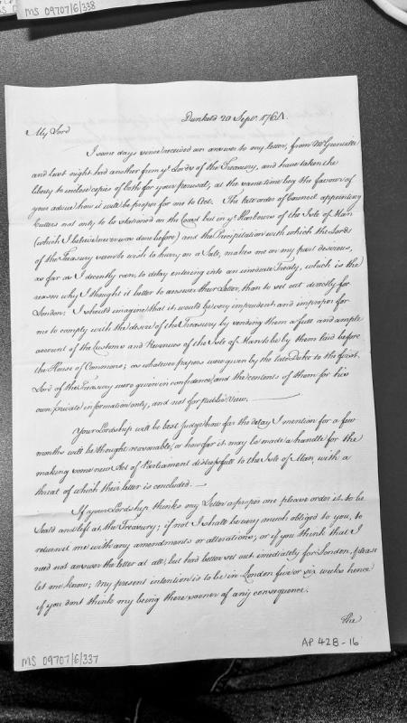
A letter from Dunkeld dated 20 September 1761 discussing correspondence with Mr Grenville and the Lords of the Treasury regarding the Isle of Man. The writer seeks advice on how to proceed with negotiations concerning the sale of customs and revenues, expressing reluctance to provide a full account to be laid before Parliament, citing confidentiality of prior documentation from the late Duke.
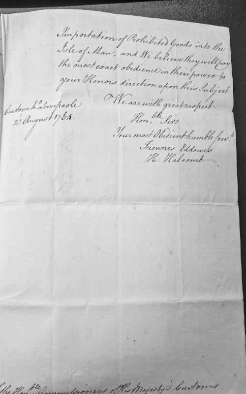
A letter from the Custom House at Liverpool dated 23 August 1764, addressed to the Commissioners of His Majesty's Customs. The authors express their belief that authorities will comply with directions regarding the importation of prohibited goods into the Isle of Man.
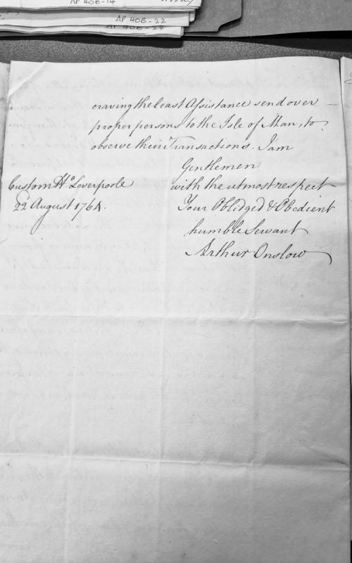
A letter fragment dated 22 August 1764 from Arthur Onslow at Custom House Liverpool, addressed to recipients requesting assistance with sending proper persons to the Isle of Man to observe transactions. The letter employs formal 18th-century epistolary conventions.
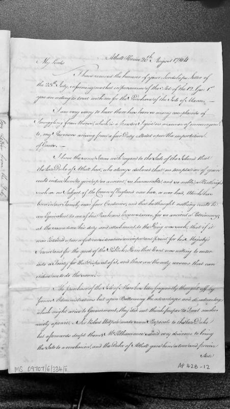
A formal letter from the Duke of Atholl to government lords responding to a proposal to purchase the Isle of Man under the Act of 12 George I. The Duke expresses reluctance to sell the ancient family patrimony held for nearly four centuries, though indicates willingness to treat if deemed essential for the King's service and public good. The letter discusses previous administrative attempts to purchase the island, including proposals by Sir Robert Walpole and Mr Pelham.
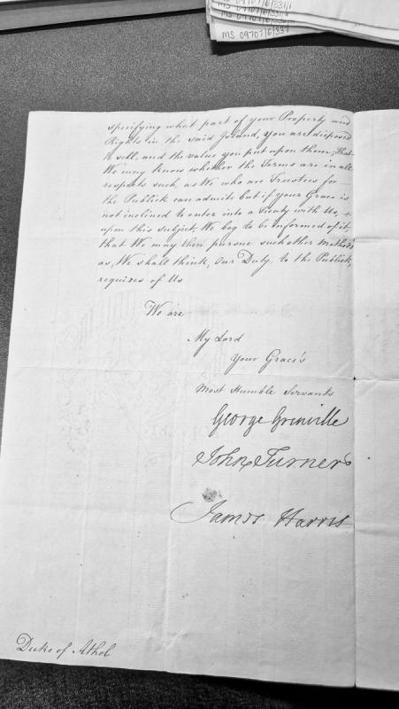
A formal letter from government trustees (Grenville, Turner, Harris) to the Duke of Athol requesting clarification on his willingness to sell property and rights in the Isle of Man. The letter indicates they act as trustees for the public interest and seek either terms for a treaty or notification of refusal to negotiate.
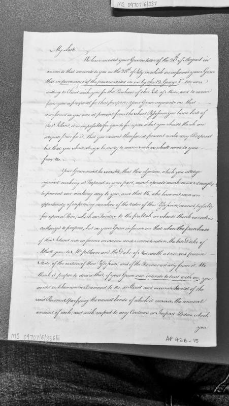
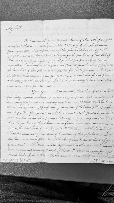
Official correspondence from government trustees (likely Board of Treasury) to the Duke of Atholl regarding a potential purchase of the Isle of Man. The letter references authority under 12 George I, discusses the difficulty of establishing a fair price without adequate information, and requests a detailed rental and revenue statement similar to one previously provided by the late Duke of Atholl to Pelham and Newcastle.
Official correspondence addressing the Duke of Atholl's reluctance to propose a price for the Isle of Man. The writers, acting as trustees under powers from George I, note that the Duke previously provided financial details to Pelham and Newcastle, and request similar documentation of revenue and rental information to facilitate negotiations.
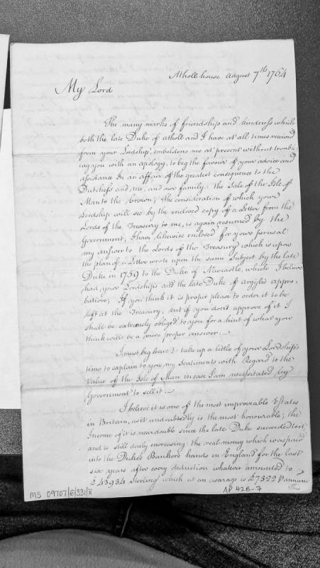
A letter from the Duke of Atholl to an unnamed Lord regarding the potential sale of the Isle of Man to the Crown. The Duke seeks advice on his response to the Lords of the Treasury and provides detailed financial information about the Isle's income over the previous six years, totalling £43,934 Sterling.
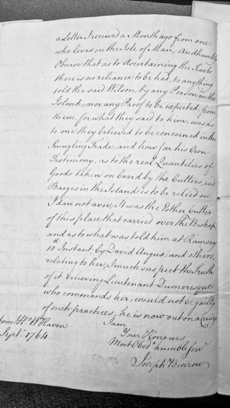
A letter from Joseph Burrow in Whitehaven to official recipients expressing skepticism about smuggling allegations involving the cutter Esther and Lieutenant Dumeresque. Burrow discusses the unreliability of testimony from Isle of Man residents and questions claims made at Ramsay regarding the vessel's activities.
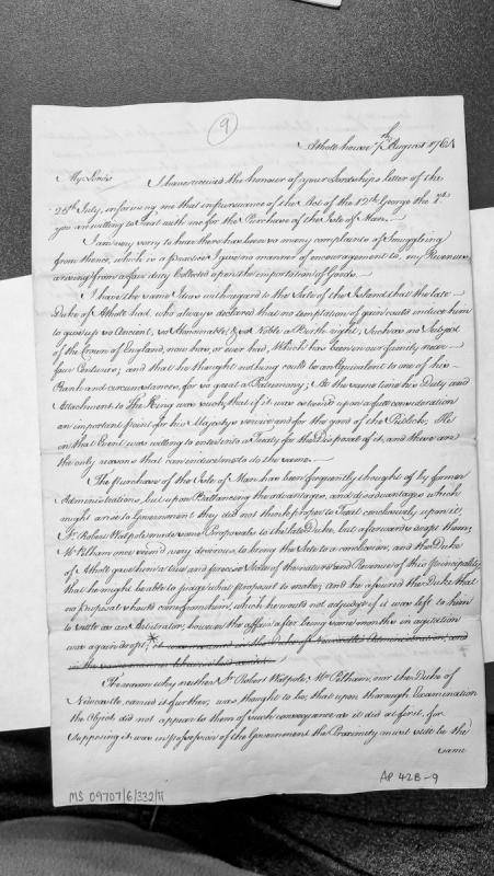
A letter from the Duke of Athole to a Lord regarding the Crown's offer to purchase the Isle of Man under the Act of 12 George III. The Duke explains his reluctance to sell this ancient hereditary possession despite its historical significance, but indicates willingness to negotiate if it serves the King's interests. He discusses previous governmental attempts to acquire the island under Walpole, Pelham, and Newcastle.
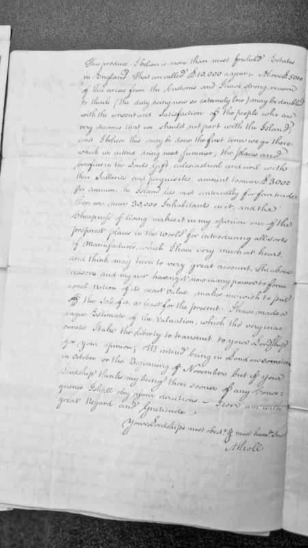
A letter discussing the financial value and potential of the Isle of Man, including revenue from customs, ecclesiastical and civil positions, and opportunities for manufacturing. The writer proposes deferring the sale of the island and requests the recipient's opinion on a valuation estimate.
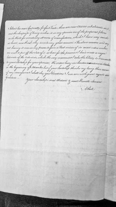
A letter fragment discussing the Isle of Man's suitability for trade and manufacture, with approximately 30,000 inhabitants and favorable cost of living. The writer defers the sale of property pending a proper valuation and indicates plans to be in London in October or November.
A State Paper from the Scottish Office (5 Jac I) addressed to Sir John Popham and other judges, requesting legal review of patents concerning the succession to the Isle of Man following the death of Ferdinand, Earl of Derby. The letter relays a petition by the Earl of Derby, Earl of Huntington, Lord Chandois, and Sir John Egerton (heirs general) seeking to challenge the Crown's claim to the island, which Queen Elizabeth I had assumed by royal prerogative. King James I has ordered a hearing and now requests written opinions on any defects in the patents under English law.
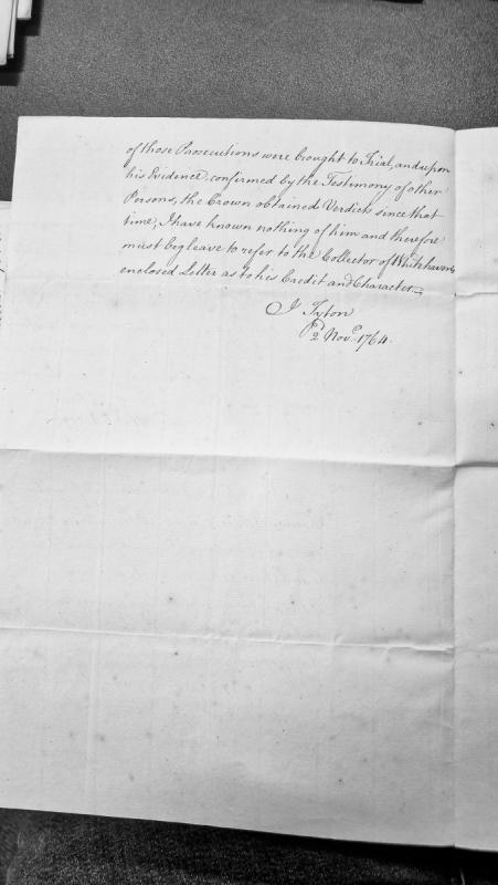
A brief administrative letter from I. Tyton dated November 2, 1764, concerning prosecutions brought to trial and the credibility of a witness. The author refers to enclosed correspondence from the Collector of Whitehaven regarding the subject's character and credit.
Letter from Castletown officials (Dan Mylrea and John Quayle) to the Duke of Atholl dated 24 July 1765, reporting on conditions following the Revestment. Discusses the reinstatement of Mr. Quayle as Clerk of the Rolls, outstanding tea duties owed by merchants, and widespread smuggling operations in harbours around the Isle, including details of clandestine landing methods using cutters and night landings at remote creeks.
Official correspondence from Isle of Man administrators (Mylrea and Quayle) to the Duke of Atholl regarding post-Revestment governance issues, including the reinstatement of Mr Quayle as Clerk of the Rolls, merchant disputes over tea duty payments, and the practical difficulties of enforcing landing procedures amid intense smuggling activity. The letter reveals the extent of contraband operations and merchant non-compliance in May 1765.
Administrative letter from Manx officials (Mylrea and Quayle) to the Duke of Atholl reporting the seizure of wreck tobacco by revenue officer Betham and requesting guidance on the Duke's rights to wrecks under the 1765 Revestment Act. The letter documents a conflict between traditional ducal wreck rights and post-Revestment Crown authority over wreck goods.
Administrative letter from officials (Mylrea and Quayle) to the Duke of Atholl concerning an application by Mr Arthur for a licence to occupy and develop land on Douglas Quay, Isle of Man. The letter discusses a pre-existing stable and coach house built circa 1756 and a new application for additional yard space, with proposed rent of 5 shillings annually. Illustrates landlord-tenant relations and property administration in the immediate post-Revestment period under ducal sovereignty.
Administrative letter from Manx officials (Mylrea and Quayle) to the Duke of Atholl concerning a property application by Mr Arthur for land at Douglas Quay. The letter discusses Arthur's prior occupation of a stable and coach house built ~10 years earlier under Governor Cochrane, and his request for an additional plot and consolidated grant. References harbour proximity, proposed rental payments (5s per year), and mentions Kennedy's bill for £251 12s 1d.
Letter from Dan Mylrea and John Quayle to the Duke of Atholl reporting the discovery of wrecked tobacco off the Isle of Man coast and challenging the authority of the revenue officer Mr Betham to claim wrecks for the Crown. The writers assert that wrecks historically belonged to the Duke and seek Treasury guidance on future wreck jurisdiction following the 1765 Revestment Act.
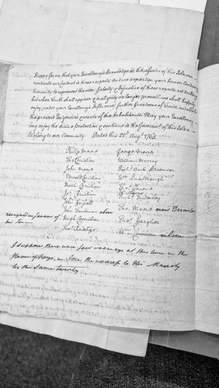
A letter addressed to the Governor ('your Excellency') from representatives of the Isle of Man, defending their conduct against false reports and petitioning for expanded trade freedoms. The document is signed by twenty members, apparently representing the House of Keys, and expresses confidence in the Governor's support.
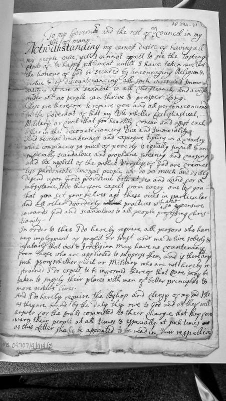
A letter from the Lord of Man (likely the Duke of Atholl) to the Governor and Council of the Isle of Man, emphasizing the need to promote religion, virtue, and moral conduct while suppressing drunkenness, swearing, and other vices. The letter requires government officials and clergy to actively work together to maintain moral standards and set examples of sober, virtuous conduct.
A discursive letter examining the state of the Manks language, its literary output, biblical translations, and scholarly works on the Isle of Man. The author surveys the efforts of Bishop Hildesley and the Society for Promoting Christian Knowledge to publish religious texts in Manks, and provides a comprehensive bibliography of works on Manx history and culture up to 1797. Relevant to understanding the cultural and religious context of the island during the Revestment period.
A substantial letter discussing the state of the Manks language, its preservation and literary development, the publication of religious texts in Manks (1760s–1790s), and a comprehensive bibliography of works on Isle of Man history and culture. Includes specimen Manks texts, linguistic analysis, and details of the Society for Promoting Christian Knowledge's distribution efforts. Highly relevant to understanding cultural conditions on the Island during the Revestment period and immediately after.
Comprehensive administrative and statistical survey of Isle of Man covering ports and creeks (appointed 1776), fairs calendar, parish registers (1647–1796), population figures (1726–1792), vicars/clergy (1798), post-office operations, revenues (1790–1791), import/export duties, commodity trade volumes, and commentary on smuggling suppression post-Revestment. Includes comparative data on Isle of Wight.