Extract from Paul Henri Mallet's 1770 work on Northern Antiquities, tracing Scandinavian (Norwegian and Danish) conquest and control of the Isle of Man and northern islands. Covers the 1266 sale of the Hebrides and Isle of Man to Scotland by Magnus Lagabætter, the 1468 mortgage of Orkney and Shetland to James III of Scotland, and the persistence of Norse law and language into the 17th century. Provides historical context for understanding pre-Revestment sovereignty claims over the Isle of Man.
Extract from Paul Henri Mallet's Northern Antiquities (1770) discussing Scandinavian conquest of northern islands, the 1266 sale of the Hebrides and Isle of Man to Scotland by Magnus Lagabætter, and the later mortgaging of Orkney and Shetland to James III in 1468. Provides historical context for Norse/Scandinavian rule and the transition of Manx sovereignty.
Manannan House, on Market Square, began life in the late eighteenth century as a public house known as The George, owned by John Murray, 4th Duke of Atholl. The War Office acquired the building in 1828 and converted it into barracks around 1830, and it served as a garrison until the troops were withdrawn in 1896. In 1911 the War Department sold the property to the Castletown Commissioners for £600, and it became the town's Town Hall, remaining so until a new civic centre was built in 1989, after which the building passed into private ownership and was renamed Manannan House. Today it houses retail and leisure tenants on Castletown's main square.
This three-storey stone building is rectangular in plan with a slate pitched roof. The stonework is exposed on the upper two storeys as cut blocks with random horizontal coursing. The ground floor is cement rendered to window sill level of first floor. There is a regular deployment of five vertically proportioned windows at each floor although the middle of the ground floor is designed as a semi-circular headed front entrance. The fenestration is rather modest, the only adornment being a plain cement rendered frame around the upper floor windows and a straight rectangular molding at the top of the ground floor rendering panel. There are no particularly significant features to the building either internally or externally. For the most part details are rather poorly handled, an example being the traversing of the main facade by electrical wiring clipped to the masonry, a single angle bracket light, a token flag-pole etc. As a town hall the building clearly has civic significance and it occupies a prominent position in an area which has already recommended to have a listing as a group related to its function.
The above description was prepared prior to the creation of Registered Building and Conservation Area legislation.
The structure has since been placed on the Protected Buildings Register (No. 17).
The building has served a variety of uses since being constructed for domestic use, including as the town hall, and later as offices. It is currently in commercial use.
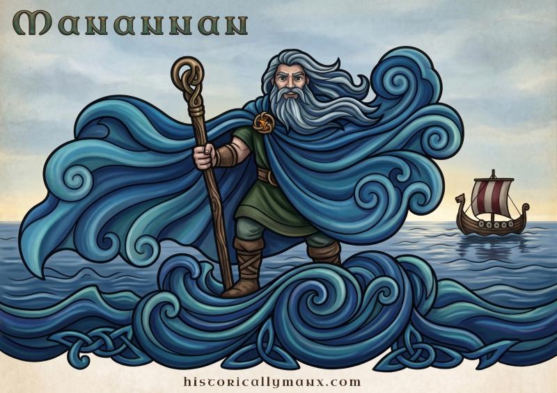
Manannán wrapped his island in mist to hide it from invaders. The Traditionary Ballad records the method: "It was not with his sword he kept it, neither with arrows or bow, but when he would see ships sailing, he would cover it round with a fog." The Supposed True Chronicle adds that he "kept, by necromancy, the Land of Man under mists," and that if he feared an enemy, "he would of one man cause to seem an hundred, and that by art magic."
The Manx Gaelic word for this power is cloagey druiaght — the invisible cloak, rendering invisible at pleasure the person who wore it. Roeder recorded the term in 1904, sitting in a list alongside fer obbah, pishag, and guesag — the wider Manx magical vocabulary still in living use at the turn of the twentieth century. It is not borrowed from the Irish féth fíada tradition. It is a Manx word for a Manx concept.
In Irish mythology the cloak does more than hide islands. In the Wasting Sickness of Cúchulainn, Manannán arrives in a magic mist, takes his wife Fand back from the Ulster hero, and shakes his cloak between them so they can never meet again. Cúchulainn takes a draught of forgetfulness. The cloak separates lovers and erases memory. That is a different kind of power from the one the Manx stories describe, and rather less comfortable.
Whether anyone still believed in the mist by the eighteenth century is another question, but the old sense persisted that the Island was a place apart, sheltered, hidden, answerable to its own customs. Hall, writing in the 1880s, put it simply: "The mists of Little Mannanan, son of Lear, did not forsake our island when Saint Patrick swept him out of it. They continued to come up from the south, and to conspire with the rapid currents from the north to drive ships on to our rocks." The mist outlasted the god. Or the god outlasted the saint.
Prehistoric flint scatter.
A small quantity of worked prehistoric flint was recovered from the vicinity of Manannan's Chair by CH Cowley.
The description relates to OS Field no. 0662, which is centred at the grid reference provided.
The antiquary Charles Harry Cowley was an avid collector of worked flint and coarse stone artefacts revealed by agricultural activity, mainly on farms located around Peel, and occasionally from further afield. He was active from 1900 until 1943. His entire collection of artefacts, together with a daybook cataloguing his discoveries, was later donated to Manx National Heritage.
Ringfort. The now-discontinuous embankment of this plough-damaged site indicates a structure originally about 35m in diameter. Only the western and northern arc of the bank now survive, the former incorporated into a field boundary. Although the bank to south and east are largely ploughed down, the raised platform of the interior is still apparent.
The surrounding field has produced several worked flints.
An ecclesiastical mandate from John Sharp, Archbishop of York, authorizing the induction, installation, and enthronement of Thomas Wilson as Bishop of Sodor and Man. The document confirms Wilson's nomination by the Earl of Derby (as patron), acceptance by King William III, and consecration by the Archbishop. It includes the form of installation ceremony performed on 11 April 1698 by Samuel Wattleworth, Archdeacon. The text is presented in both English and Latin versions.
An ecclesiastical mandate from John Sharp, Archbishop of York, dated 20 January 1697, formally installing Thomas Wilson as Bishop of Sodor and Man. The document includes the Latin original and English translation, with attestations of installation dated 11 April 1698. Relevant to understanding the Isle of Man's ecclesiastical governance and the formal procedures by which bishops were appointed and installed during the period leading up to the 1765 Revestment.
Collection of three previously published essays by David Craine on early modern Manx history: 'The Killing of William Mac a Faille' (1639), 'Sorcery and Witchcraft' (16th–18th centuries), and 'Church and Clergy, 1600–1800'. Edited and reprinted by Stephen Miller in 1994. Based on close-reading of Manx Museum manuscript holdings, these essays provide insights into Manx legal procedure, folk belief, ecclesiastical governance, agricultural practice, and social structures during the period preceding the Revestment.
The Manx Air Derby was an air race held on the Isle of Man, with sporadic races from 1924 and the first official Derby run in 1936 over a 156-mile course on Whit Monday, notably featuring accomplished aviator Alex Henshaw. The event continued until the Second World War halted it, resumed in 1947, and was revived again in 1965 at Jurby Aerodrome, later run alongside the Tynwald Air Races.