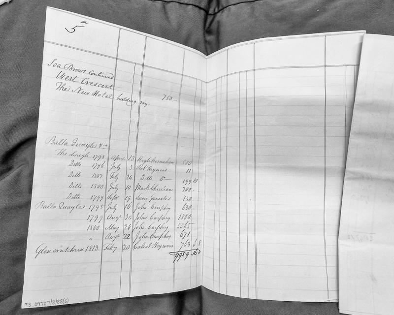
A financial abstract listing property valuations and payments for locations including Sea Brows (West Crescent), The Lough at Balla Quayle, and Glencrutchres. The document records multiple transactions dated between 1793 and 1813, with amounts in pounds, shillings and pence, and identifies various payers including Hugh Bernahan, Robert Heywood, Mark Christian, Lewis Geneste, and John Curphey.
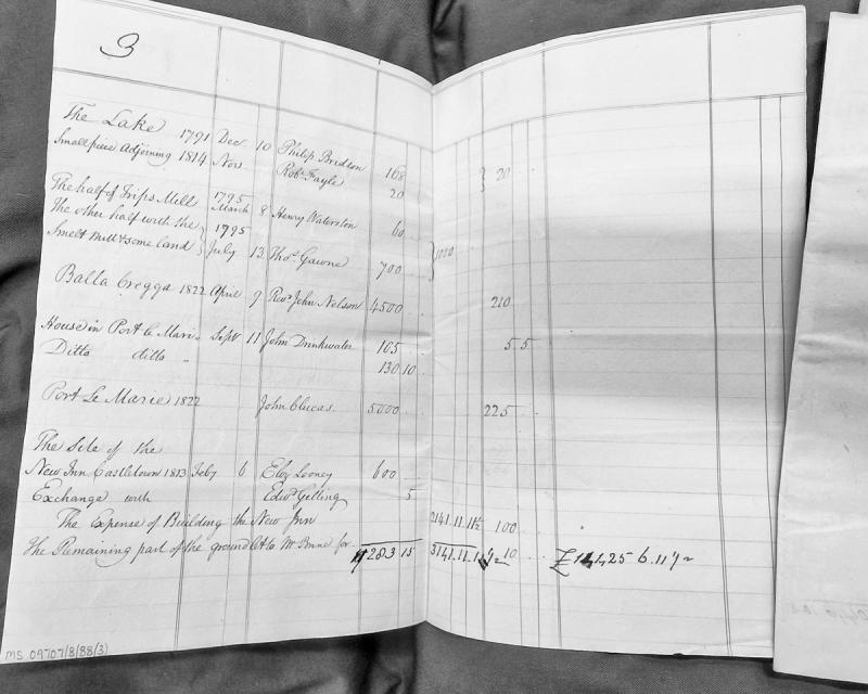
A revenue abstract or valuation roll listing various properties on the Isle of Man with associated dates of acquisition or transaction, owners' names, and monetary values. The document records land holdings including mills, houses, and ground plots across locations such as The Lake, Port le Marie, Castletown, and Balla Gregga, spanning the period 1791-1822.
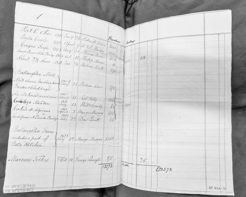
A revenue abstract listing various parcels of land and property with associated dates of valuation, owners/purchasers, and monetary values. The document records transactions spanning from 1791 to 1822, including mills, farms, meadows, and tithes primarily in the Marown and Ballaughton areas. Financial totals suggest this may be part of a property assessment or estate valuation record.
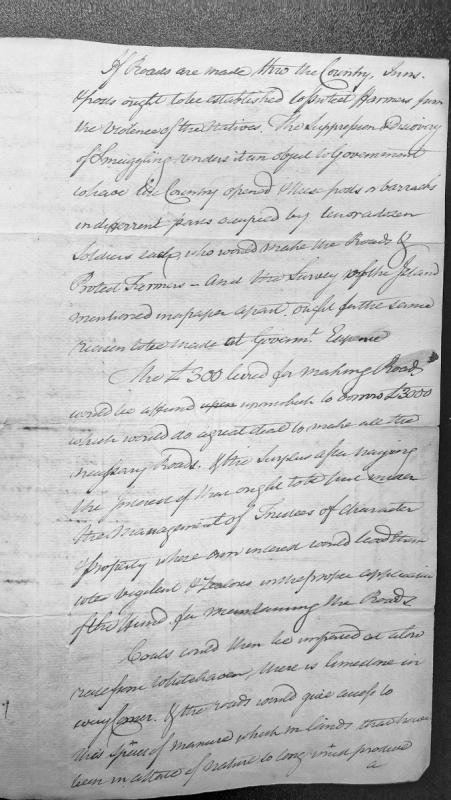
A policy proposal discussing the establishment of roads, inns, and military posts across the Isle of Man to protect farmers and suppress smuggling. The document outlines a financial scheme leveraging £300 in road levies to borrow £3000, with management by trustees, and discusses economic benefits including coal imports and limestone access for agricultural improvement.
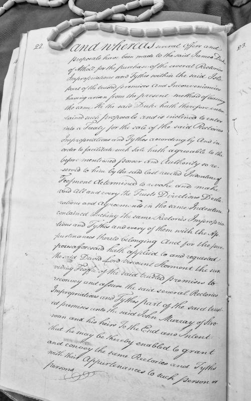
Legal document concerning the Duke of Athol's proposal to sell rectories, impropriationes and tythes within the Isle of Man. The document outlines the Duke's intention to revoke previous trust arrangements and reconvey these properties through John Murray of Strowan to facilitate their sale.
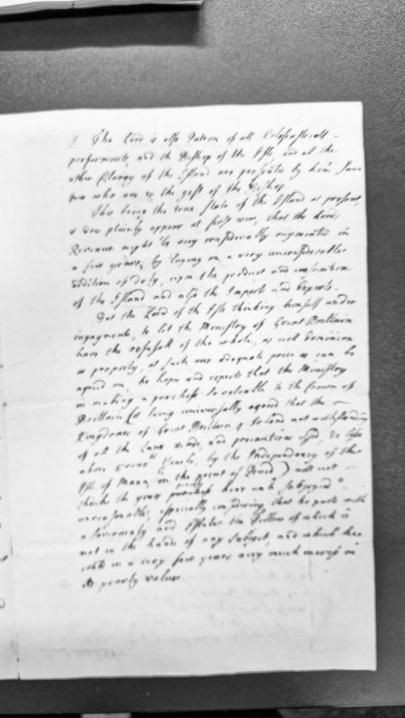
A document presenting the Lord of the Isle of Man's proposal to sell the island's dominion and property to the British Ministry. It details the Lord's ecclesiastical patronage rights, potential revenue augmentation through taxation, and argues for a fair price based on the sovereignty's value and the revenue losses suffered by Great Britain and Ireland due to the Isle of Man's independence.
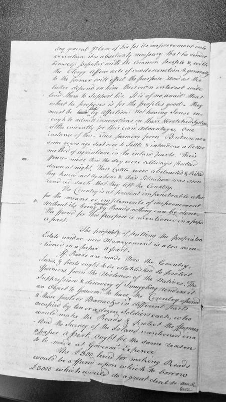
Fragment of a longer administrative document containing proposals for the improvement of the Isle of Man. The author discusses the necessity of gaining popular support for reforms, describes resistance to agricultural innovation, and outlines infrastructure and security measures including road-building, establishment of inns and posts, suppression of smuggling, and placement of soldiers for protection and road maintenance.
A detailed proposal by Charles Lutwidge, Receiver and Surveyor General of Isle of Man, submitted to the Lords of the Treasury describing illicit trade in Guernsey (similar to pre-Revestment Manx smuggling) and recommending regulatory measures. Highlights the continuation of smuggling networks post-Revestment, particularly the Danish rum trade through agents like Taubman and Parr, and its impact on North American colonial commerce and Irish provision prices.
Charles Lutwidge, Receiver and Surveyor General of the Isle of Man, submits proposals to the Lords of the Treasury regarding illicit trade in Guernsey and the Channel Islands. The document compares current smuggling in Guernsey to the pre-Revestment smuggling trade of the Isle of Man, detailing the importation of Danish rum via Guernsey and the activities of major smuggler Taubman. It argues for trade regulations to suppress foreign spirits smuggling.
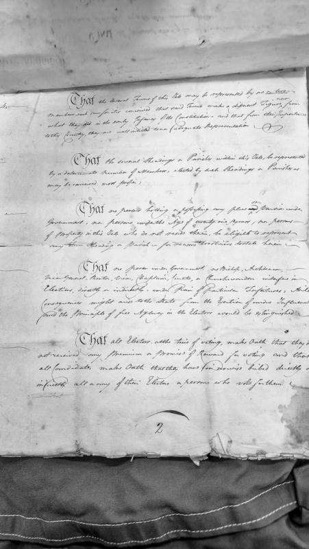
A set of proposals for reforming parliamentary representation in the Isle of Man, detailing eligibility requirements for representatives, restrictions on clerical interference in elections, and provisions for electoral oaths to prevent bribery and undue influence.
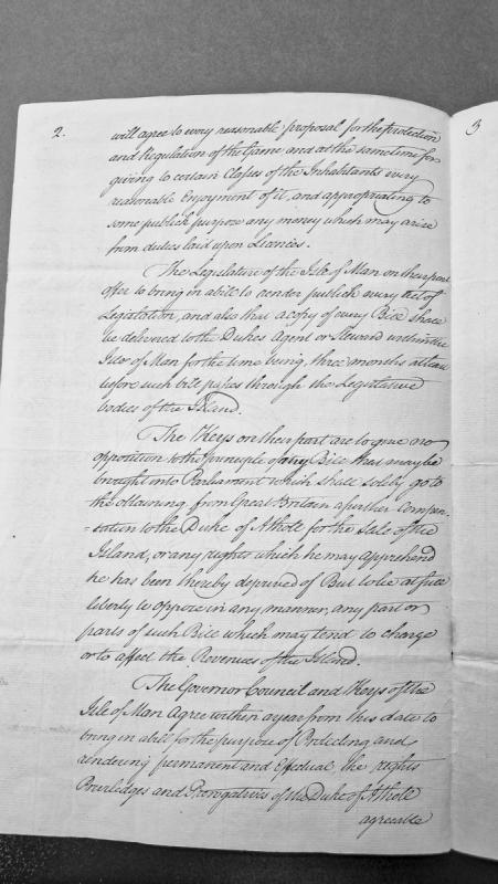
This document outlines proposed agreements between the Legislature, House of Keys, Governor, and Council of the Isle of Man regarding game protection, public access to legislation, and compensation to the Duke of Atholl for the sale of the island. It details mutual commitments to bring forward bills protecting the Duke's rights and privileges while regulating hunting and public enjoyment of game.
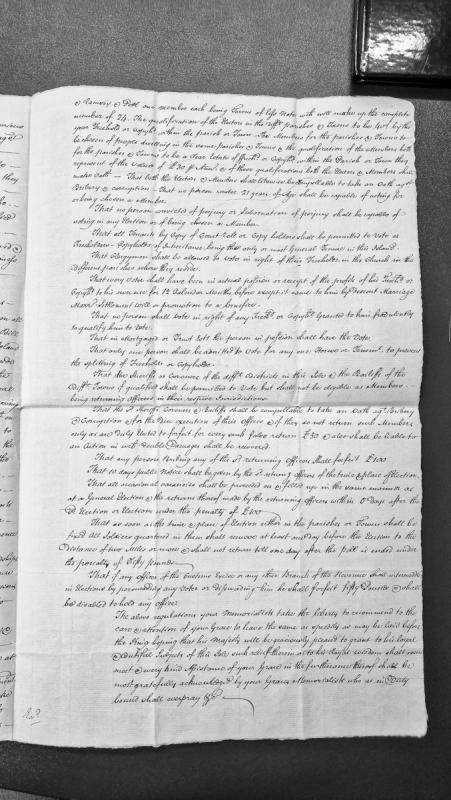
A petition presenting detailed proposals for electoral reform in the Isle of Man, including voter qualifications, candidate eligibility requirements, and procedures for elections in parishes and towns. The document outlines specific regulations regarding freehold and copyhold tenure, age requirements, oaths against bribery, and penalties for various electoral offenses.
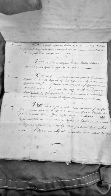
This document outlines proposed constitutional regulations for the House of Keys, including provisions for a Speaker, election dispute resolution, legislative powers, and a septennial election cycle. It addresses the governance structure and rights of the Keys in relation to the Governor and Council.
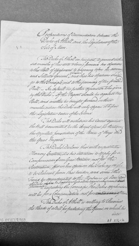
A memorandum of agreement setting out proposed terms of settlement between the Duke of Atholl and the Manx Legislature regarding disputes over the Bill of Assessment, appellate jurisdiction, herring customs, and game protection. The Duke agrees to submit objections to legal review and withdraw opposition to certain measures in exchange for consideration of compensation claims.
A medieval protection letter issued by the Marquis of Ireland to John, Bishop of Sodor, dated 24 October 1317, as the bishop prepared to travel to the Isle of Man in attendance upon the King and Marquis. The document is recorded in the Patent and Close Rolls of the Irish Chancery (10 Edward II). This source provides evidence of ecclesiastical authority and administrative structures in medieval Man.
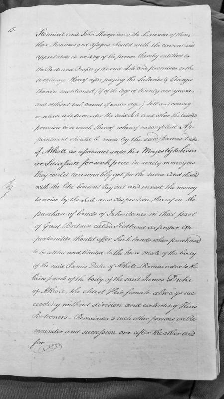
A legal document outlining the conditions under which Stormont and John Sharpe, as trustees and survivors, may sell the Isle of Man and other premises with appropriate consent. The proceeds are to be reinvested in Scottish lands settled on the heirs of James Duke of Atholl, with specific entail provisions favoring male heirs and excluding portioners.
Modern watermill.
The Ordnance Survey 1:2500 First Edition mapping of 1867-8 depicts a watermill at this location, annotated as 'Flour Mill'.
The site is now occupied by Pulrose power station.
Modern mill leat.
The Ordnance Survey 1:2500 First Edition mapping of 1867-8 depicts the tail-race from Ballaughton Mill forming a leat parallel to the River Dhoo and extending 330m, at which point it was augmented by water from two streams flowing from the west, before continuing a further 150m to power Pulrose Mill.
The entire course of the River Dhoo has been altered following the development of National Sports Centre and Pulrose power station, following the former course of the leat for part of its length, and the leat no longer survives above ground.
The grid reference relates to the midpoint of the former leat for reference purposes.
Modern tail race.
The Ordnance Survey 1:2500 First Edition mapping of 1867-8 depicts the tail-race from Pulrose Mill, extending a distance of 260m before rejoining the River Douglas at SC3690075540.
The final 80m of the tail race still survives, but the remainder lies beneath warehouses on the Middle River industrial estate.
The grid reference relates to the midpoint of the former tail race for reference purposes.
Iron Age earthwork. The site appears as a substantial mound set in a wetland basin. The Ordnance Survey recorded two concentric earthwork banks, the outermost of which extended eastwards under the modern road. These features if real are rather less pronounced today. Nevertheless the substantial central mound is quite prominent to the west of the roadside.
Excavations by Peter Gelling were cut short by his untimely death, but his investigations were sufficiently advanced for him to propose settlement activity, including the presence of structures, and to suggest an occupation lasting until as late as the 7th century AD based on the recovery of E-ware.
More recent excavations by the Centre for Manx Studies towards the edge of the mound found evidence for ironworking, and material radiocarbon dated to the 1st or 2nd century BC.
Iron Age earthwork. The site appears as a substantial mound set in a wetland basin. The Ordnance Survey recorded two concentric earthwork banks, the outermost of which extended eastwards under the modern road. These features if real are rather less pronounced today. Nevertheless the substantial central mound is quite prominent to the west of the roadside.
Excavations by the Centre for Manx Studies towards the edge of the mound found evidence for ironworking, and material radiocarbon dated to the 1st or 2nd century BC.
Iron Age earthwork. The site appears as a substantial mound set in a wetland basin. The Ordnance Survey recorded two concentric earthwork banks, the outermost of which extended eastwards under the modern road. These features if real are rather less pronounced today. Nevertheless the substantial central mound is quite prominent to the west of the roadside.
Excavations by Peter Gelling were cut short by his untimely death, but his investigations were sufficiently advanced for him to propose settlement activity, including the presence of structures, and to suggest an occupation lasting until as late as the 7th century AD based on the recovery of E-ware.
This is a Python script designed to automatically download and archive web-based transcriptions from the Manx Notebook's Manx Society Volume 4 collection. It is not a historical document or source material, but rather a technical tool used to capture primary source transcriptions from the isle-of-man.com domain.