The site of an Iron Age Roundhouse. It survives as an almost circular earthwork with an average overall diameter of 25.0 metres which is set on marshy ground and heavily overgrown with fern. Though the fern makes field investigation difficult, the feature appears to be both by construction and by topographical situations a typical Roundhouse of circa 200 AD. The interior is raised above the exterior by 0.3 metres and around its circumference is a bank with an average width of 1.7 metres and average inner height of 0.2 metres. Outside the bank is a fragmentary berm average 3.0 metres wide and 0.3 metres high but no outer ditch could be traced in the reed covered ground. In the north the bank appears to split with the west portion swinging in towards the centre and the east portion swinging away from it thus creating a gap of 4.0 metres. This may be an entrance not shown on maps.
The Roundhouse is shown on the 1870 1:2500 Ordnance Survey map and named as The Buggane. This map shows a lake to the southwest side of the monument.
The site of a Bronze Age barrow which was examined in 1928 and produced a broken cinerary urn which is now kept in the Manx Museum. Mr E. Martin, a previous owner, provided information that when the highroad at this point was lowered, an urn with bones and ashes was found and reburied.
The site of a Bronze Age barrow which was examined in 1928 and produced a broken cinerary urn which is now kept in the Manx Museum. It is a grass and gorse covered mound partly destroyed in the north by a road cutting and with a sheer retaining wall 1.4 m high in the east and south. The barrow mound has a maximum height of 3.1 metres and is 14.0 metres north to south by 9.0 metres east to west. Mr E. Martin, a previous owner, provided information that when the highroad at this point was lowered, an urn with bones and ashes was found and reburied.
The site of a post-medieval horse engine. The circular horsewalk is shown on the 1870 1:2500 scale Ordnance Survey map, located at the southeastern end of a building to the northern side of the farmyard. The building and the horsewalk circle are still visible on modern aerial photographs.
The Smelt Monument was built to commemorate Cornelius Smelt (1748-1832), who in 1805 became the first royally-appointed Lieutenant Governor of the Isle of Man following the Revestment in 1765 which transferred control of the Isle of Man from the Duke of Atholl to the British Government.
The Smuggling Act 1765 was one of the suite of legislation enacted alongside the Revestment to suppress the Isle of Man's role as a centre for the redistribution of dutiable goods. Together with the Purchase Act and the Mischief Act, it formed the legal framework by which the British government sought to bring the Island's trade under direct Crown control and prevent its use as a base for evading British and Irish customs duties.
A detailed historical chapter from a 1900 comprehensive history of the Isle of Man, covering the rise and evolution of smuggling from its beginnings in the late 17th century through 1765. It traces the legislative and administrative responses by Manx Lords and the English government, the role of major smuggling merchants like Maguire and Poole, key commodities (tobacco, tea, spirits, East India goods), and the growing conflict between revenue protection and the island's economy. Directly relevant to understanding the economic and political circumstances leading to the 1765 Revestment.
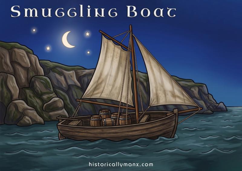
An extensive contemporary analysis of smuggling operations from the Isle of Man, extracted from Malachy Postlethwayt's Dictionary of Trade and Commerce. It details the scale of illicit trade (estimated at £700,000 annual loss), the routes, cargoes, vessels, and operational methods, while arguing for either purchasing the island from the Duke of Atholl or implementing effective enforcement measures. Includes a merchant petition from Whitehaven.
Extract from Malachy Postlethwayt's Dictionary of Trade and Commerce (1755) detailing the scale and mechanisms of smuggling operations from the Isle of Man, including routes, goods, vessels, revenue loss estimates, and proposed remedies. Includes a memorial from Whitehaven merchants. Highly relevant to understanding pre-Revestment smuggling economy and contemporary calls for Crown acquisition.
Chapter 2, Section 3 from a 1900 History of the Isle of Man covering the social and economic history of smuggling post-Revestment (1765–1866). Details the immediate chaos following the Mischief Act of 1765, the resumption of smuggling, the 1767 Act, and the eventual suppression of illicit trade through enforcement measures and the Act of 1798. Includes eyewitness accounts and Commissioners' recommendations.
A scholarly chapter examining the illicit smuggling trade in Ireland and the Irish Sea during the eighteenth century, with particular focus on the Isle of Man's role as a smuggling entrepôt until 1765. The text covers smuggling commodities (spirits, tobacco, tea), enforcement difficulties, the closure of the Isle of Man loophole, subsequent shifts to Guernsey and Continental sources, quarantine-breaking, and marine crimes including wrecking. Directly relevant to understanding the economic context and consequences of the 1765 Revestment.
A scholarly essay examining smuggling networks, quarantine violations, and maritime crime in 18th-century Ireland, with particular emphasis on the Isle of Man's role as a smuggling entrepôt before its acquisition by the British government in 1765. The text traces specific smuggling operations, merchant networks (including the Black family based in Bordeaux), and coastal lawlessness, providing detailed case studies relevant to understanding the commercial and strategic context of the Revestment.
Snaefell is the highest point on the Isle of Man, rising to 2,036 feet. Its name derives from the Norse for "snow mountain", reflecting the Island's Norse heritage. Watch and ward was kept continuously on its summit, day and night, winter and summer, and if danger appeared, the beacon was set on fire to alert the Island's inhabitants.
The only true mountain on the Island, clearing the minimum qualifying height of 2,000 feet by a mere 36 feet. The Norse called it snow mountain. From the summit, on a clear day, you can see England, Scotland, Ireland, and Wales simultaneously. The old saying goes that you can see seven kingdoms from Snaefell: Mann itself, the four surrounding countries, Heaven, and the Kingdom of Manannan. Snaefell receives seventy-five inches of rain in an average year, nearly twice what falls on most of lowland England.