A legal opinion from Castle Rushen addressed to the Duke of Atholl concerning the naturalization of four Roman Catholic merchants (Thomas Arthur, John Folie, Hugh Connor, Francis Dean) in the Isle of Man. The opinion argues that secular privileges of native-born inhabitants should be extended to long-resident foreign merchants regardless of religious persuasion, emphasizing the Isle's religious stability and the distinction between religious and commercial rights under Manx law.
A legal opinion from the Duke of Atholl's officials (Castle Rushen) addressing the naturalization and trading privileges of four Roman Catholic merchants (Arthur, Folie, Connor, Dean) in the Isle of Man. The document outlines Manx sovereignty, native privileges, the Lord's prerogative to naturalize foreigners, and argues that naturalization concerns secular justice and trade equality, not religious conformity. It affirms the Isle's Protestant establishment and notes the absence of penal statutes against Catholics.
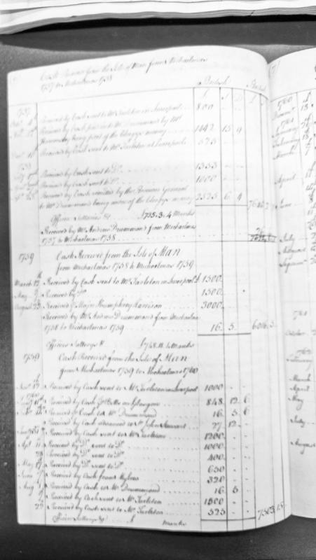
A revenue abstract recording cash received from the Isle of Man between Michaelmas 1757 and 1760, with detailed entries of payments sent to Mr. Tarleton in Liverpool and Mr. Drummond, including Bishop's money allocations and officers' salaries. The document tracks financial transactions across multiple years with amounts in pounds, shillings, and pence.
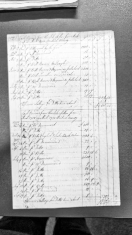
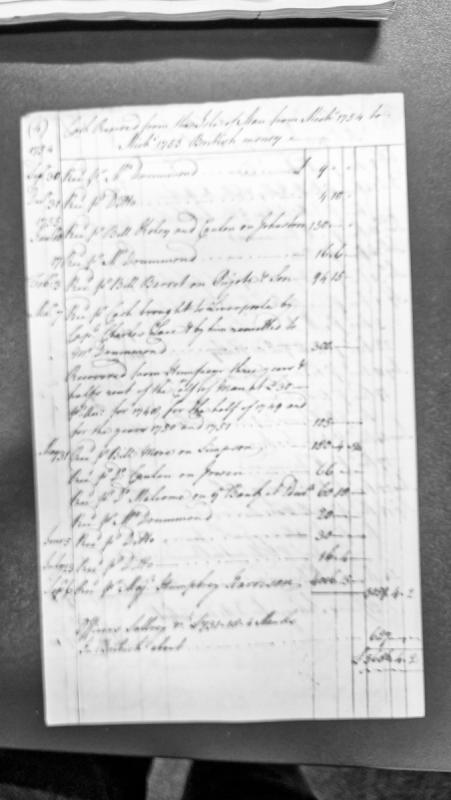
A financial accounting document recording cash receipts from the Isle of Man over two consecutive accounting periods (Michaelmas 1749-1750 and Michaelmas 1750-1751). The document lists individual payments received via various intermediaries including Mr Drummond, bills drawn on named parties, and bank notes, with amounts in British currency.
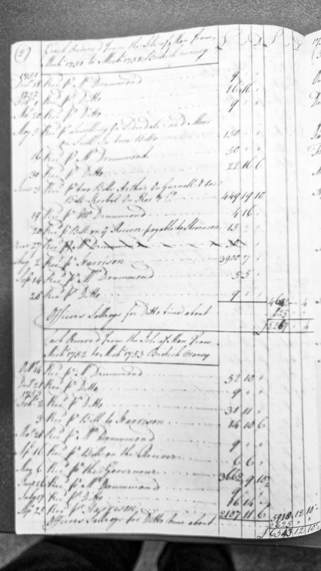
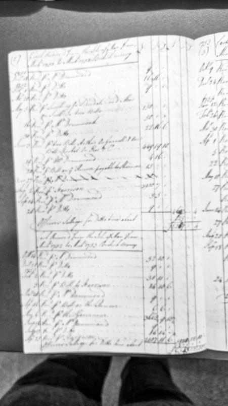
Revenue abstract recording cash receipts from the Isle of Man across two accounting periods: Michaelmas 1751 to Michaelmas 1752, and Michaelmas 1752 to Michaelmas 1753. Documents payments received through various intermediaries and bills, with totals including officer salaries.
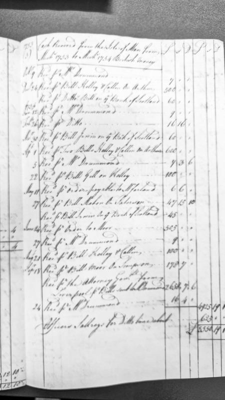
A revenue abstract recording cash receipts from the Isle of Man over a twelve-month period from October 1753 to September 1754. The document lists individual payments received through various agents and bills of exchange, with amounts in British money (pounds, shillings, pence), and concludes with a total after deducting officers' salaries.
A financial account detailing cash receipts from the Isle of Man over a twelve-month period from September 1754 to September 1755 in British currency. The document records multiple payments received through various intermediaries and agents, including rent from the Cell of Man, and includes a total accounting of approximately £5055 4s 2d.
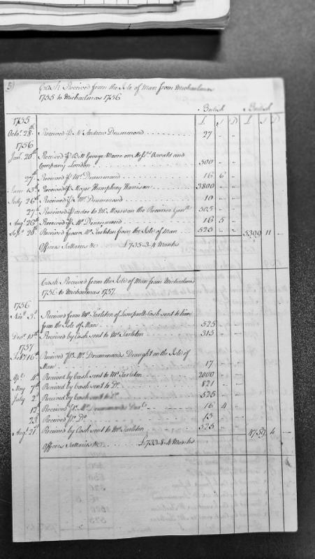
A financial abstract recording cash receipts from the Isle of Man covering two accounting periods: Michaelmas 1755 to Michaelmas 1756, and Michaelmas 1756 to Michaelmas 1757. The document lists individual payments received through various intermediaries, with totals and notes on officers' salaries paid in Manx currency.
A financial record documenting cash transfers removed from the Isle of Man between Michaelmas 1752 and Michaelmas 1753, recorded in British currency. The document lists individual transactions with dates, payment methods (primarily via Drummond and bills), and amounts in pounds, shillings, and pence. Includes officer salary information for the same period.
Iron Age defended promontory; medieval watch station. The site is protected by an earthen bank and ditch across the landward side, and on the north side by precipitous cliffs on the north and east. The bank is 7m wide with a maximum inner height of 1.5m and outer height of 2.2m. A ditch to the landward of this is 6m wide on average and 1m deep, though it has suffered plough damage.
Excavation by PS Gelling in 1957 showed that the rampart was faced with dry walling inside and out and was 3.8m wide. The excavator believed that both faces were part of a reconstruction, for they stood on a layer of slatey rubble and building stone, which was thought to be Iron Age in origin. The rebuilding of the rampart probably took place before the construction of the rectangular longhouse within the enclosed promontory. Prior to investigation, there were surface indications of the building, but excavation proved it to be orientated NW-SE, with bowed walls and internal measurements of 7.5m by 4m. There was a possible entrance 2m wide in the south-east corner, but no trace of stonework. Apart from a few postholes for support for the roof and entrance, little else survived to indicate the construction of the walls, which seem to have been of earth and turf. There was a rudimentary raised bench along each long wall and at the west gable, formed by cutting down into the bedrock in the centre of the building; here there was also a hearth.
The excavator believed that the house represented Medieval reoccupation of the site. More recently it has been argued that the building was used as a watch-house as part of a system of watch and ward, and did not serve a domestic purpose.
Iron Age defended promontory.
The site is protected by an earthen bank and ditch across the landward side, and on the north side by precipitous cliffs on the north and east. The bank is 7m wide with a maximum inner height of 1.5m and outer height of 2.2m. A ditch to the landward of this is 6m wide on average and 1m deep, though it has suffered plough damage.
Excavation by PS Gelling in 1957 showed that the rampart was later faced with dry walling inside and out and was 3.8m wide. Gelling believed that both faces were part of a period of medieval reconstruction, since they stood on a layer of slatey rubble and building stone, which he thought was Iron Age in origin. This interpretation is crucial in establishing an Iron Age date for the origin of the site, as no Iron Age features were recognised within the defended area of the promontory, and had presumably been effaced by later medieval activity.
Medieval defended promontory.
Excavation by PS Gelling in 1957 showed that the rampart was refaced with dry walling inside and out and was 3.8m wide. Gelling believed that both faces were part of a period of medieval reconstruction and re-use, since they stood on a layer of slatey rubble and building stone, which he thought was Iron Age in origin.
Prehistoric coarse stone tool.
A worked prehistoric coarse stone tool was acquired by CH Cowley from Mr C Cashin of Market Place, Peel.
No further details concerning the circumstances of the discovery were recorded and the grid reference relates to the finder's address for indicative purposes only.
The antiquary Charles Harry Cowley was an avid collector of worked flint and coarse stone artefacts revealed by agricultural activity, mainly on farms located around Peel, and occasionally from further afield. He was active from 1900 until 1943. His entire collection of artefacts, together with a daybook cataloguing his discoveries, was later donated to Manx National Heritage.
The possible site of an undated fort, said to be located to the south of a fort on Gob ny Rona or Tableland Point. It appears to have been mentioned by P.M.C Kermode but no evidence of such a monument has been found and later sources believed the record to be erroneous, possibly a confusion with the fort on the point (PRN 1073.00).
It may however refer to the Civil War battery thought to have stood on the point before the Gob ny Rona battery was built in the late 18th to early 19th century.
Ringfort. This impressive oval earthwork survives to a maximum height of 4.6m. The bank, which averages 7m in width, has a diameter ranging from 31 to 35m. There is an entrance on the north-east side. Apart from the enclosure being built up on the north-west side to create a more-or-less level interior, there is no sign of any internal features.
The site has been compared to the circular structure at the Braaid, and stands at a roughly similar altitude, but here the likeness ends as there is no sign of any stone in the bank at Cashtal Lajer.
A cairn is shown here on the 1870 1:2500 scale Ordnance Survey map, located on the boundary between the Ballaugh and Jurby parishes. It may have been of Neolithic or Bronze Age date but no longer survives as a surface feature.
The possible site of an Iron Age or Early Medieval promontory fort, although the features here have been interpreted as being of geological origin.
The site is found on a projection of the brooghs and appears to be defined by a ditch measuring 7 metres wide and 1 metre in depth which cuts off the narrow neck of the promontory to the southwest. This creates an isolated shelf or "island" of flat ground which is taken to represent the interior of a fort. Fragments of a possible outer bank have been noted outside the ditch. It has been suggested that the "ditch" has been caused by a natural geological slip caused by coastal erosion. However, this part of the coastline appears to have remained stable since the time of the 1870 1:10560 scale Ordnance Survey map, which shows the promontory fort and names it as Cashtal Ree Gorree.
The old name of the local estate, Balyhamig, was recorded in 1515, and has been traced by antiquarians to the Scandanavian name Hamnarvik i.e. Harbour creek. This has led to the conjection that this is might be a defensive work of late date with Viking or post-Viking association but there is no other evidence to support this.
Cashtal yn Ard, near Cornaa in Maughold parish, is a Neolithic chambered tomb dated to around 2000 BC and considered one of the best-preserved megalithic monuments of its kind on the Isle of Man. A west-facing forecourt measuring roughly 6.7 by 5.8 metres leads into five stone chambers arranged eastward along a structure some 39 metres long overall. Excavations by H. J. Fleure and G. J. H. Neely in the 1930s recovered flints, pottery sherds, and around 125 white sea pebbles, though no human bone survived. Set on high ground with extensive views of the surrounding landscape, the tomb's position may have marked a symbolic separation between everyday farmland below and ritual activity conducted above. Its architecture has been compared by researchers to the Giants' Tombs of Sardinia and the Bridestones of Cheshire, linking it to a wider European megalithic tradition.
The burial cists within the well-preserved Neolithic chambered tomb of Cashtal yn Ard is situated on raised land giving views overlooking most of the parish of Maughold and across the sea to the Lake District. Although the stone cairn has been stripped away, the largest, firmly-set stones create a dramatic burial site.
The impressive arcade of the sharply curved forecourt, now restored, measures 6.7m wide by 5.8 metres deep. The largest of the stones forming the forecourt stand 2.3 metres above ground level. Five stone-built chambers extend eastwards from the forecourt, each chamber separated from its companion by lateral stone slabs. The maximum height of the stones forming the chambers is 1m, gradually reducing eastwards. The longest of the chambers is 3.2 metres and the shortest is 2 metres long; the average width is 1.2 metres. The overall length of the tomb is 39 metres.
Large quantities of prehistoric worked flint, said to number in the thousands, have been observed and collected at Cass ny Hawin. Material has been observed at various points along the coastal periphery of Ordnance Survey Field no. 2969, and also as a result of ploughing. The site is now affected by quarrying. Two trial excavations were undertaken by Gelling and Cubbon in 1973 prior to an extension of quarrying in the vicinity. No significant discoveries were made, but an adjoining area to the east requires similar investigation.
An Iron Age or early medieval promontory fort which may have been occupied in the 5th - 6th century AD. It is situated on a natural promontory above the Santon River. It utilises almost vertical drops to the north and west for protection and is defended to the south and east by an earthwork rampart with a maximum internal height of 1.7 metres. An outer ditch on the landward side is now almost ploughed out, but the remaining portion has a maximum width of 5.0 metres. The maximum depth from the outer lip is 1.1 metres with the drop from the top of the periphery bank 2.5 metres. The bank has several probably modern breaks on the landward side but no original entrance could be detected. The fort is grass-covered and no trace of internal habitations was found.
Medieval longhouse.
Prior to investigation in 1957, there were clear surface indications of a building in the interior of the fort, but excavation proved it to be rectangular and orientated NW-SE, with bowed walls and internal measurements of 7.5m by 4m.
There was a possible entrance 2m wide in the south-east corner, but no trace of stonework. Another possible entrance pierced the wall on the north-east, though this lay perilously close to the cliff edge. Apart from a few postholes for support for the roof and entrance, little else survived to indicate the construction of the walls, which seem to have been of earth and turf. There was a rudimentary raised bench along each long wall and at the west gable, formed by cutting down into the bedrock in the centre of the building. There were also signs of a central hearth, though this took the form of burnt material rather than a built structure.
The excavator believed that the house represented Medieval reoccupation of the site.
Medieval watch place.
The rudimentary construction of the medieval building, the lack of a hearth structure and the paucity of domestic rubbish has led to the site's reinterpretation as a place from which a coastal watch was kept - 'watch and ward' - and did not serve a domestic purpose.
Prehistoric flint scatter.
A small quantity of worked prehistoric flint was recovered from Cass Struan by CH Cowley.
No further details concerning the circumstances of the discovery were recorded and the grid reference relates to the point at which the watercourse reaches the beach for indicative purposes only.
The antiquary Charles Harry Cowley was an avid collector of worked flint and coarse stone artefacts revealed by agricultural activity, mainly on farms located around Peel, and occasionally from further afield. He was active from 1900 until 1943. His entire collection of artefacts, together with a daybook cataloguing his discoveries, was later donated to Manx National Heritage.